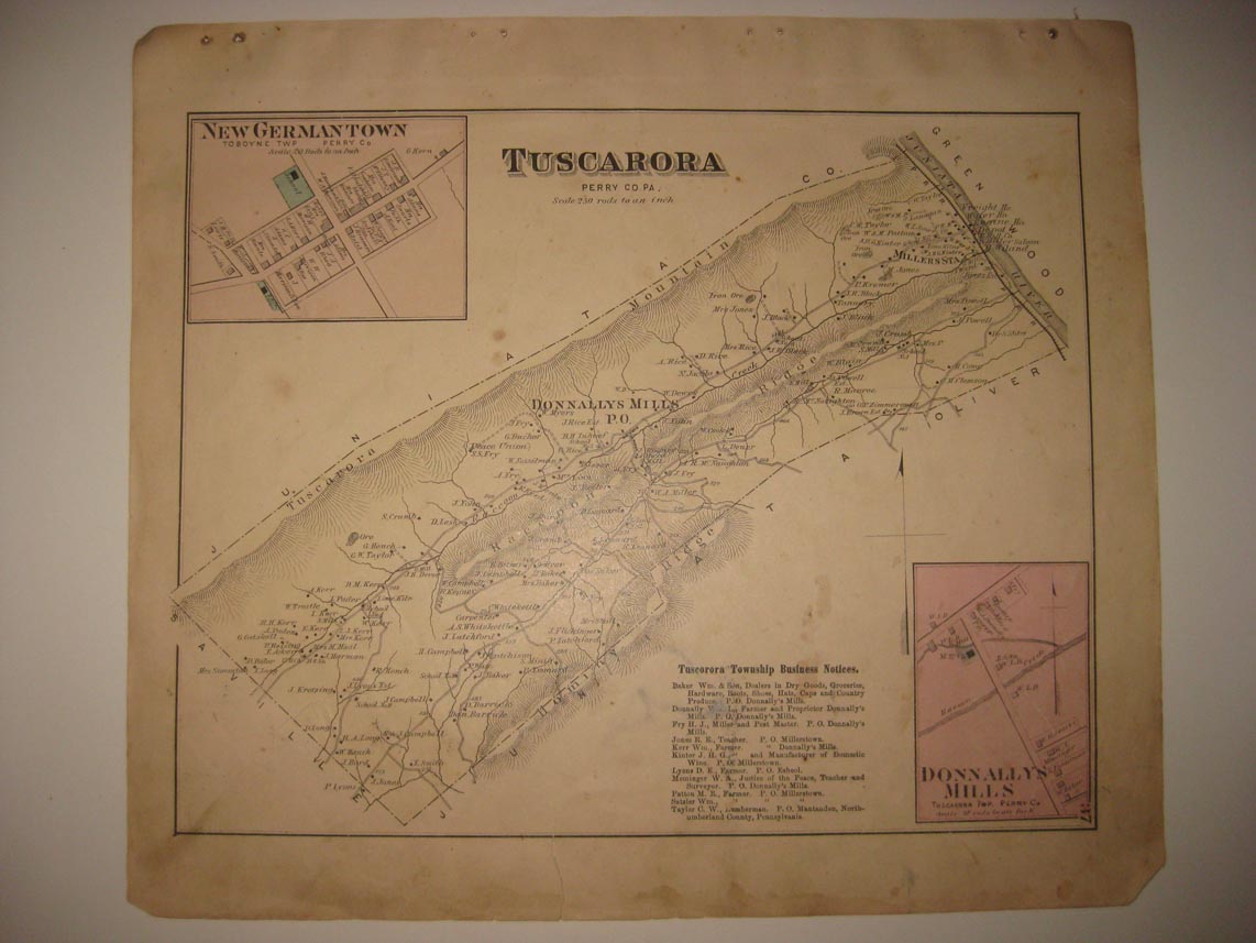
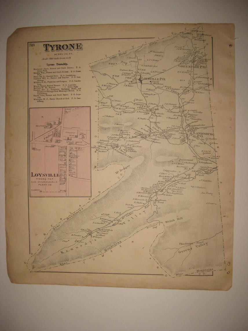
Vintage antique 1877 handcolored 2 sided map. One side is Tyrone Township, with inset map of Loysville, on the main map I see Loysville PO, Greenpark PO and more, reverse is Tuscarora Township, with inset maps of New Germantown and Donnallys Mills . The map shows the home and land owners, the business and industry, the few roads, railroads and more that existed at that time. There is some wear at outside edges, but map imagery itself is fine and should frame nicely. The map is from the very rare 1877 Pomeroy, Whitman and Company Atlas of Perry, Juniata and Mifflin County Pennsylvania. The map is a fascinating and historic period look at this area at this time. The photo wont show the full beauty of the map. The size of the map is 13" by 15". Winning bidder pays $4.00 shipping domestic, more foreign. Please see my eBay store for other rare maps for sale, at very reasonable prices.
Payment
I accept the following forms of payment:
- PayPal
Shipping & Handling
US Shipping |
International Shipping |
| FREE scheduling, supersized images and templates. Get Vendio Sales Manager. |
FREE scheduling, supersized images
and templates. Get Vendio Sales Manager.