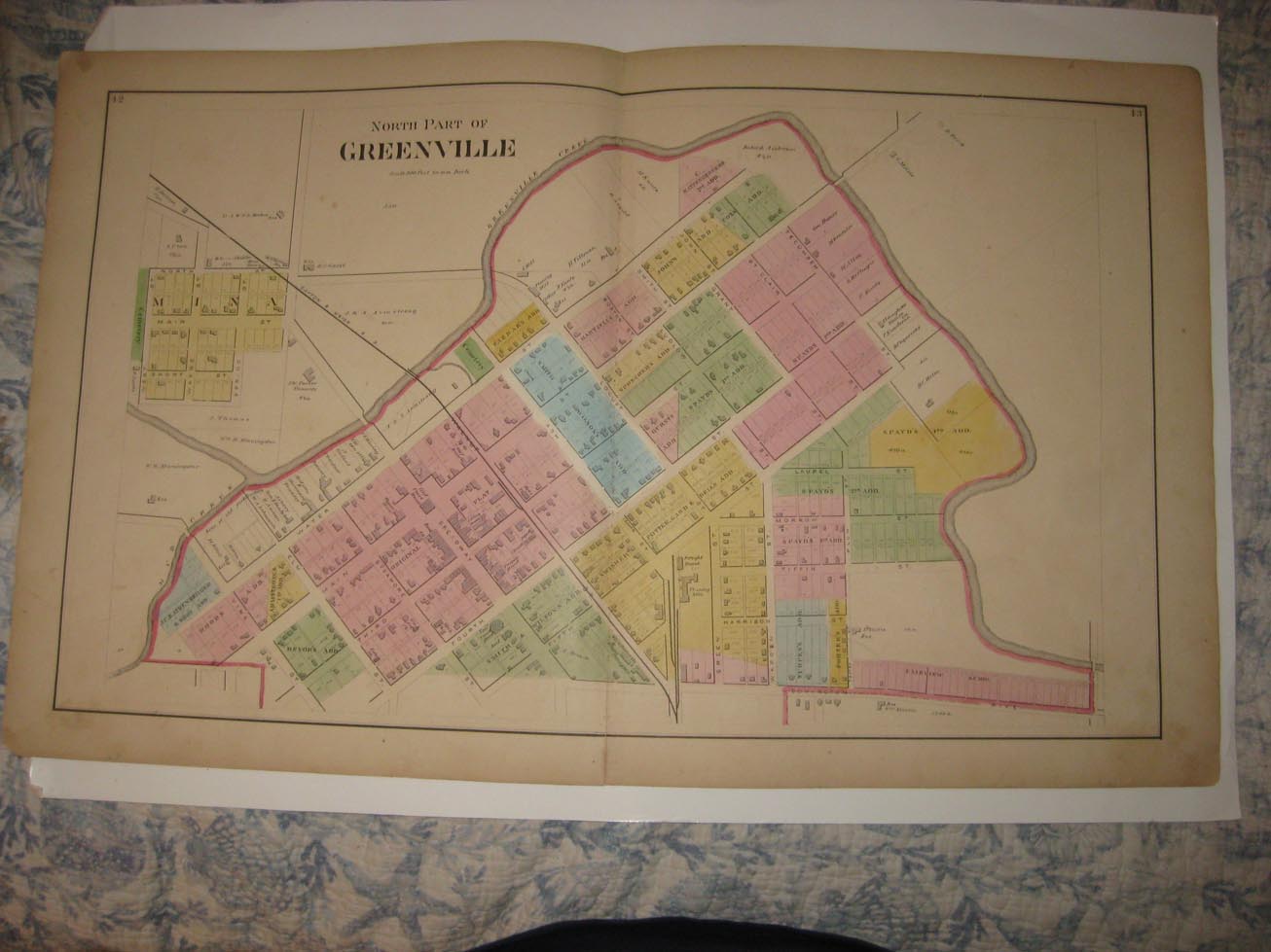
Superb, antique 1875 handcolored map. The map shows North Part of Greenville, the map is very detailed showing the named home and land owners, locations of buildings, the railroads, the roads, and much more of this period. The map is printed on very thick paper, with no printing on reverse. Fascianting and detailed period map of Darke County in 1875. Fascinating period map, shows the home and land owners, period roads, railroads, business and industry and much more. This is an antique from 1875, and is not a reprint or reproduction. The beautiful handcoloring on the map is period, this is before color printing was invented. The size of the map is 16" by 26". This would frame and display quite nicely. The map is in nice condition, and would frame and display beautifully. The map is from the rare 1875 Lake , Griffing and Stevenson Atlas of Darke County Ohio. Many fascinating period details related to these areas in 1875. Winning bidder pays $3.75 shipping domestic, more foreign airmail.
Payment
I accept the following forms of payment:
- PayPal
Shipping & Handling
US Shipping |
International Shipping |
| FREE scheduling, supersized images and templates. Get Vendio Sales Manager. |
FREE scheduling, supersized images
and templates. Get Vendio Sales Manager.