|
1894 Genuine Engraved Color Map |
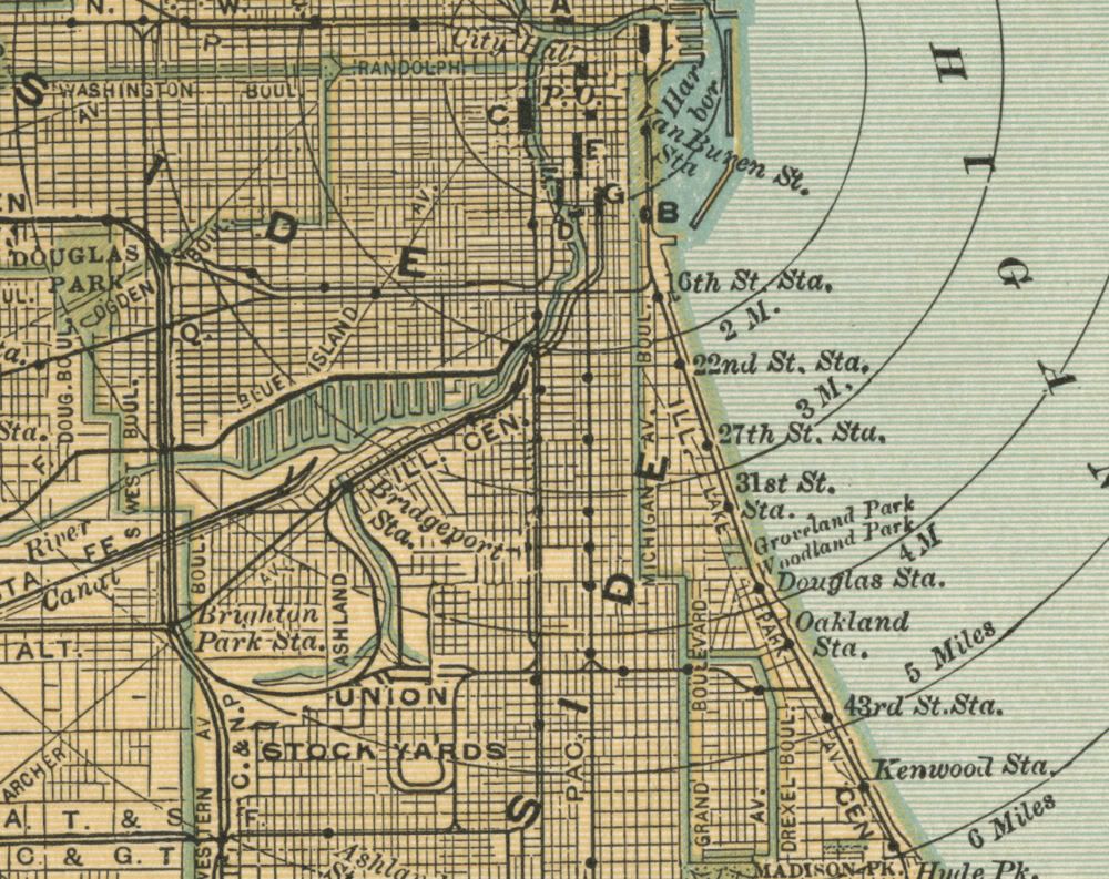
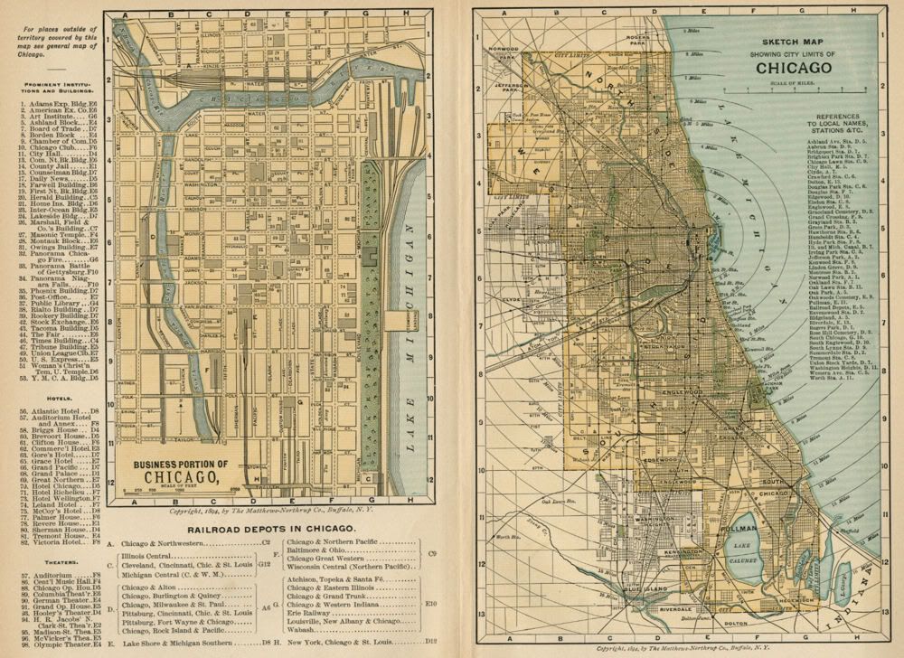
This color map of Chicago is dated 1894 on the face. It was engraved and printed by the Matthews-Northrup Works of Buffalo, NY., and issued to accompany a set of encyclopedias published in 1896. On the left half of the sheet is a map showing the Business District of Chicago, with a directory locating Railroad Depots, Hotels, Theaters, and Prominent Institutions and Buildings. On the right half of the sheet is a Sketch Map showing the City Limits (circa 1894), with a key to local Streets, Stations, Parks, and other places of interest. These two maps of the city are printed on medium weight paper, blank on the reverse, and with a fold in the center (as issued). The full sheet size is approximately 9 3/8" x 12 3/8", and the printed portion is about 8.5" x 11.5", with blank margins of between 1/4" to 1/2" all the way around to allow convenient matting. This is a very attractive pair of older maps and would look beautiful matted and framed, either together or separate. If you want an authentic map showing the city and notable businesses and places of interest as they were over 125 years ago, this is a good one. The copyright date of "1894, By The Matthews-Northrup Co., Buffalo, N.Y." appears on the face of each map, just under the lower-center border. A Note on Lithography: One of the delightful and interesting results of the engraving and ink transfer process in lithography is that there can be variants of the maps which look slightly different when compared side-by-side, even though they were produced by the same engraved plates on the same press. This may be a result of additional passes by one color or another, subtle differences in the ink tone, varying pressure from the pressing of the plates, slight variation in the position of each color plate, or other choices made by the engravers or the printers. The result is that each map's appearance is truly unique. The images below give a fairly accurate representation of this map. The first image shows the map cropped without its full margins; the second image is a close-up to show the quality and detail of the engraving. |
|
|
|
| Condition: Excellent: As shown, with no tears or marks. Map will be carefully packaged to preserve condition during shipping. Ships next business day. This is a genuine 1894 map--NOT a recent reproduction. It is nearly 130 years old; please handle with care. Satisfaction Guaranteed or RETURN for any reason within 14 days for a prompt refund. Comes from a smoke-free home. |

Powered by SixBit's eCommerce Solution