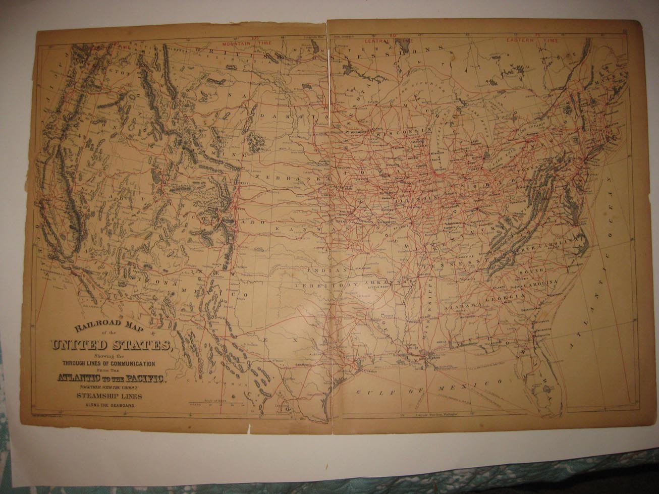
Very fine, antique 1887 handcolored map, titled Railroad Map of the United States Showing the Through Lines of Communication From the Atlantic to the Pacific, Togethor with the Various Steamship Lines Along the Seaboard. There is amn 1887 copyright at lower left hand side, this dates the map nicely. Faascianting and detailed period map of the United States, with the railroads and more shown. The map has cleanly seperated along the middle fold. The size of the map is 15" by 24". Rare. Winning bidder pays $3.75 shipping domestic, more foreign.
Payment
I accept the following forms of payment:
- PayPal
Shipping & Handling
US Shipping |
International Shipping |
| FREE scheduling, supersized images and templates. Get Vendio Sales Manager. |
FREE scheduling, supersized images
and templates. Get Vendio Sales Manager.