|
TWO 1906 (Dated) Genuine Engraved Color Maps |
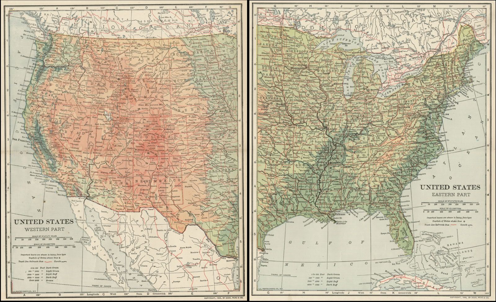
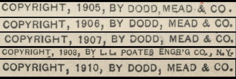
| This pair of color maps of United States: (West), and United States (East), is dated 1906 on the face of each. The pair was engraved and printed by the L. L. Poates Engraving Company, NY, to accompany a set of reference material published between 1906 and 1908. Each map locates Topographical Elements, including: Elevation, Mountain Ranges, Rivers, Bodies of Water, and other Topographical elements. Each map locates Political Elements, including: State Capitals and Major Cities State Borders, Ports, Canals, and other features, including railroads (shown in red). These two maps are each printed on medium-weight paper, blank on the reverse, with a fold in the center, (as issued). The full sheet size of each is 12 3/8" x 9.75", and the printed portion on each is about 10.5" x 8.5" with blank margins of between 1/2" to 1" all the way around to allow convenient matting. This is a very attractive pair of older maps and would look beautiful matted and framed, either together or separately. If you want authentic maps showing the region as it was over 110 years ago, this pair is a good choice. The copyright date of "COPYRIGHT, 1906, by Dodd, Mead & Co." appears on the face of each of these maps, just below the border in the lower-right corner. Just above this statement, there is another "1906" inside the map border. This indicates that the maps were copyrighted and printed by the engravers the same year as the printed reference material with which they were published. A Note on Lithography: One of the delightful and interesting results of the engraving and ink transfer process in lithography is that there can be variants of the maps which look slightly different when compared side-by-side, even though they were produced by the same engraved plates on the same press. This may be a result of additional passes by one color or another, subtle differences in the ink tone, varying pressure from the pressing of the plates, slight variation in the position of each color plate, or other choices made by the engravers or the printers. The result is that each map's appearance is truly unique. The images below give a fairly accurate representation of these maps. 1) The first image shows both maps cropped without their full margins, side by side. Please note: In the first image, both maps have been placed side by side to save bandwidth in loading the image. These are TWO separate maps, and each has blank margins all the way around the printed area, as stated in the above text. |
|
|
|
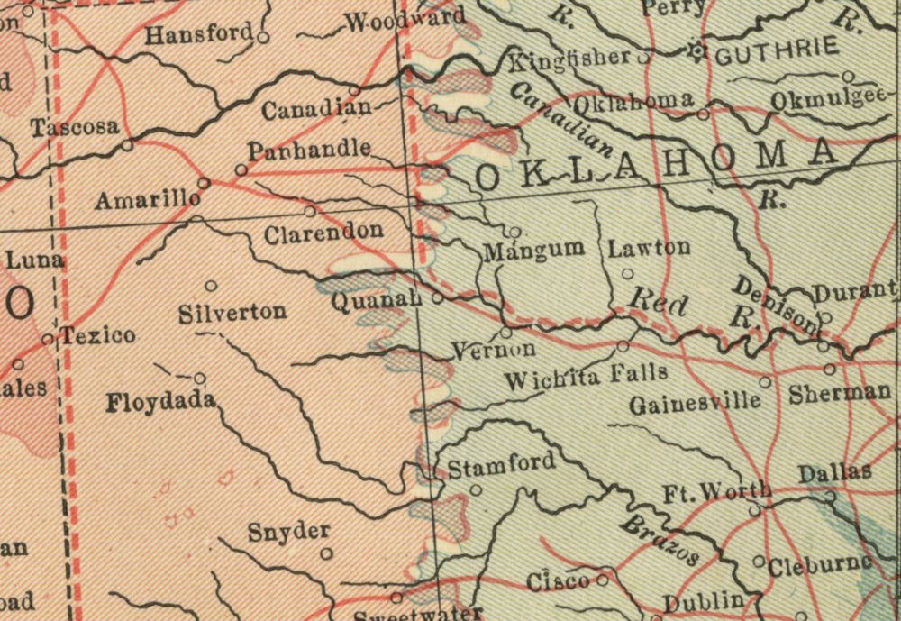
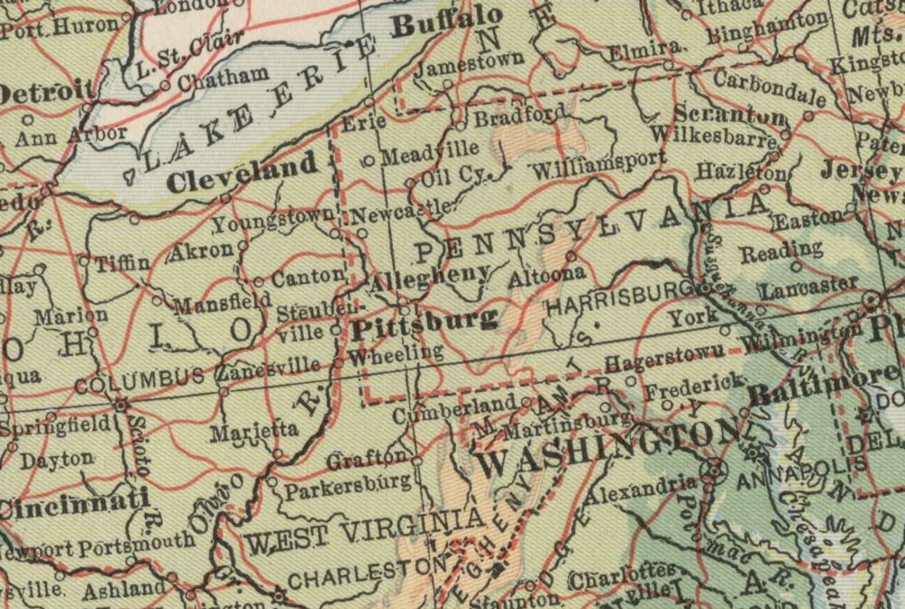
2) Below: Close-ups to show the quality and detail of the engraving. 3) Below: United States (West) map, and 5) its Key. 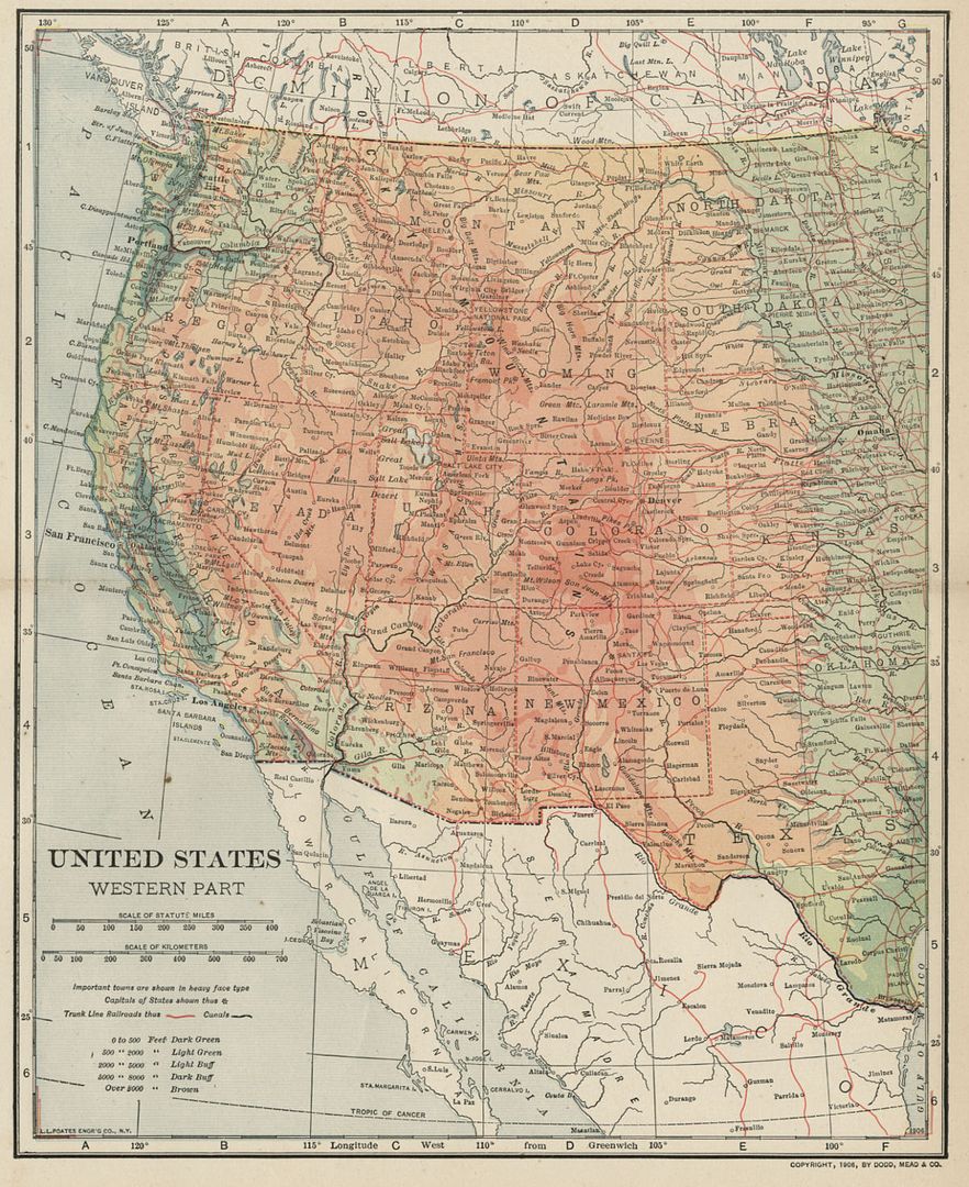 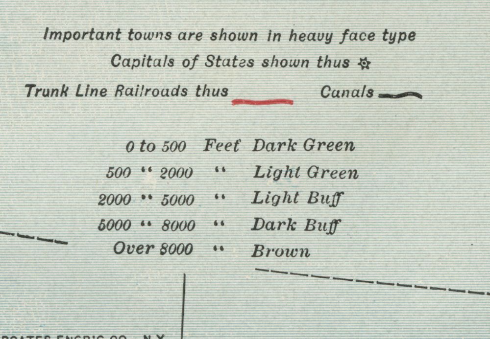 4) Below: United States (East) map 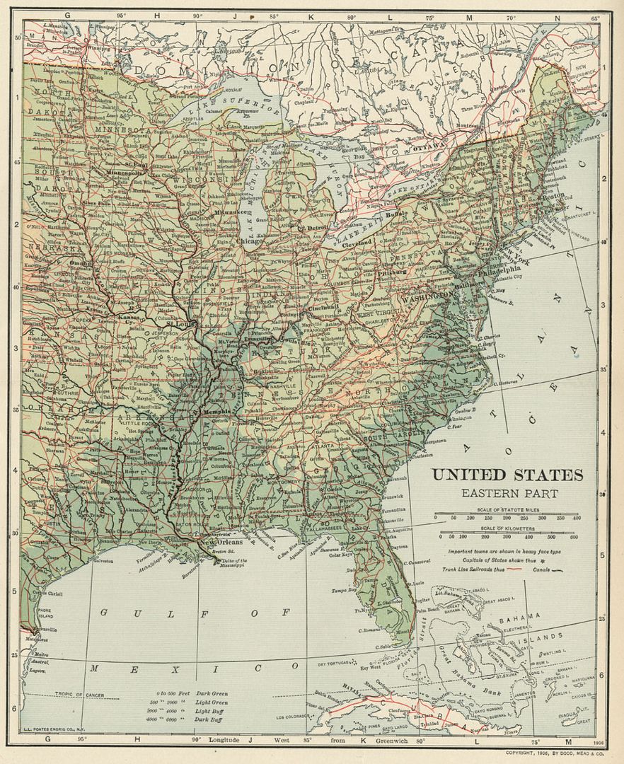 |
|
One or more of the following copyright statements appear on the face of the maps (see description above for the precise date(s). |
|
Condition: Excellent: As shown, with no tears or marks. Maps will be carefully packaged to preserve condition during shipping. Ships next business day. |