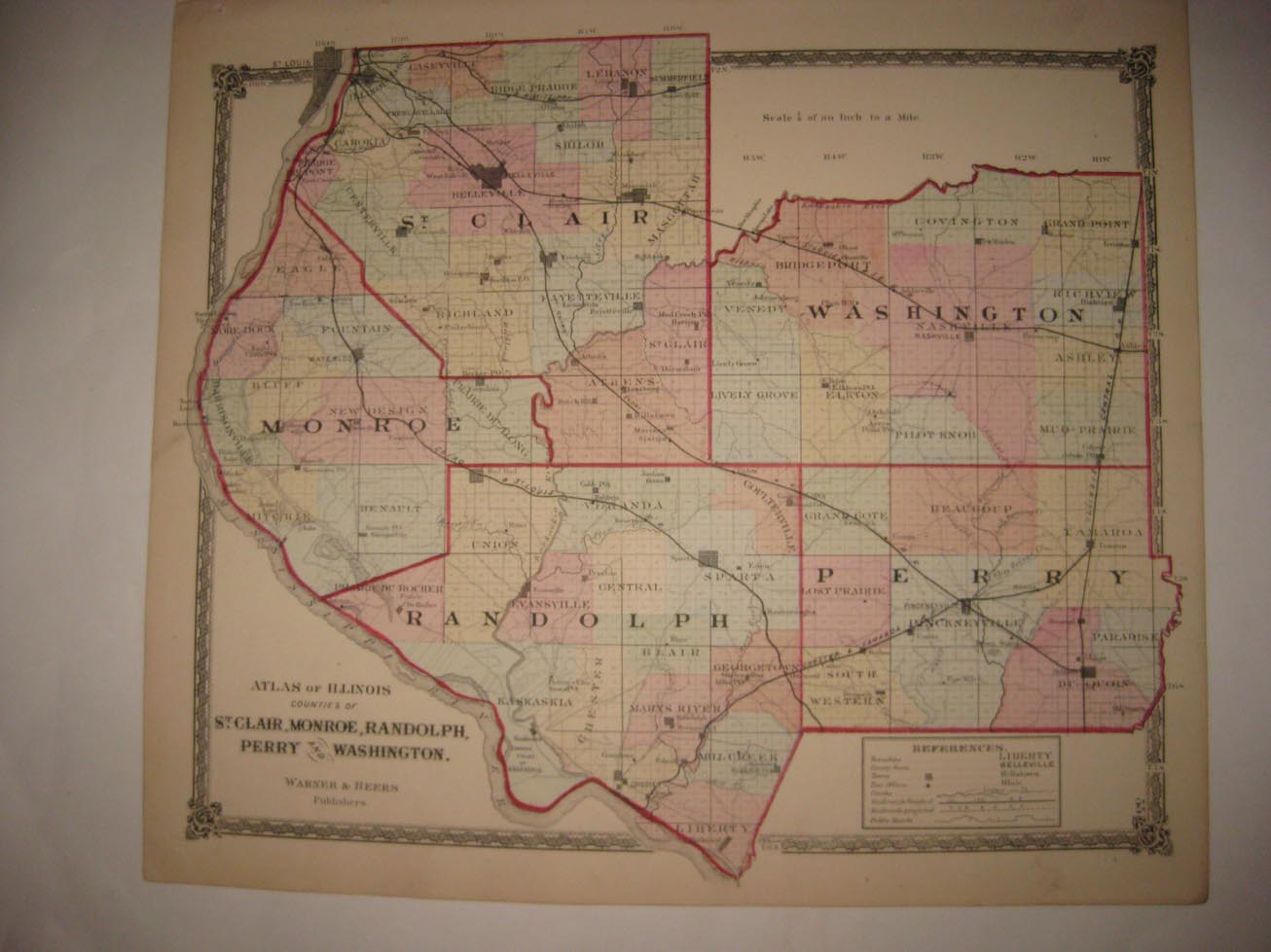
Vintage antique 1874 handcolored map, the map is absolutely gorgeous, the condition is amazing as well. The map is titled, in fine fancy antique lettering, Atlas of Illinois, Counties of St. Clair, Monroe, Randolph, Perry and Washington, Warner & Beers, Publishers, with detailed References chart corresponding to the map itself. The map is printed thick fine paper, with no printing on reverse and with gorgeous period handcoloring, nice outside ornate border, and fascianting period details. The superb handcoloring is period to the map, this is before color printing. This is an antique map and not a reprint or reproduction. The map is from the very rare 1874 Warner and Beers Illustrated Historical Atlas of McLean County Illinois. The map is a fascinating and historic period look at this area at this time. The photo wont show the full beauty of the map. The map is in nice shape and would frame and display quite beautifully. The size of the map is 16" by 18". Winning bidder pays $4.00 shipping domestic, more foreign.
Payment
I accept the following forms of payment:
- PayPal
Shipping & Handling
US Shipping |
International Shipping |
| FREE scheduling, supersized images and templates. Get Vendio Sales Manager. |
FREE scheduling, supersized images
and templates. Get Vendio Sales Manager.