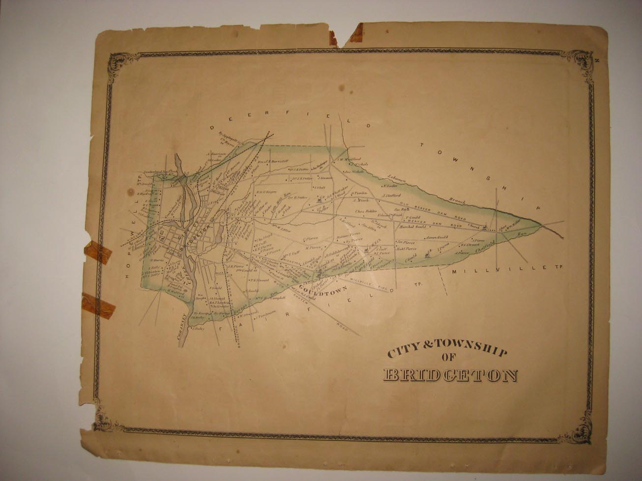
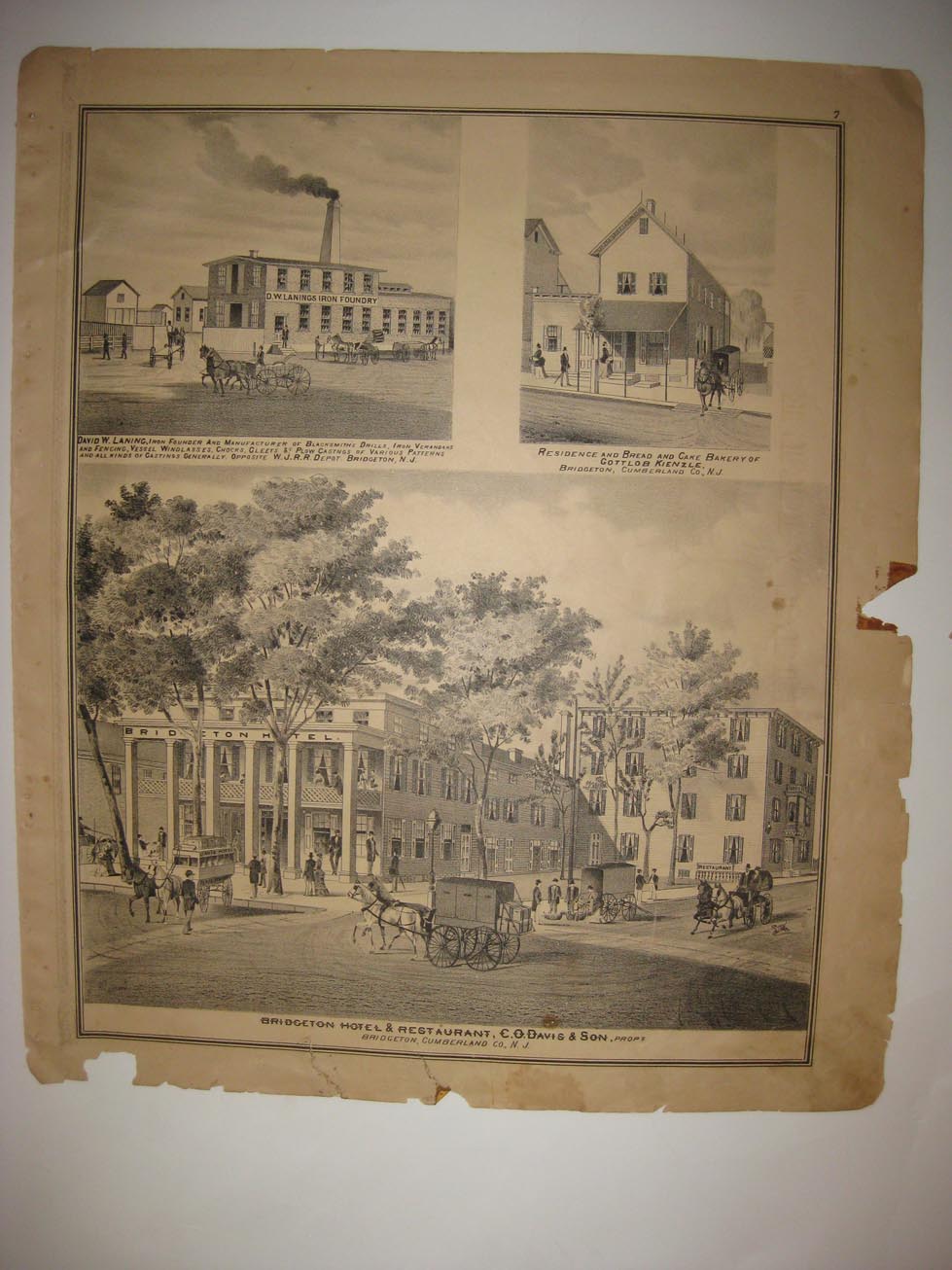
Vintage antique 1876 handcolored 2 sided map. A very rare map. The map is titled, City & Township of Bridgeton, I see Bridgeton, Gouldtown and more. The map is very detailed with the named land owners, the roads, named railroads, locations of buildings, and much more of this period. On reverse is a fine lithograph print page with Bridgeton Hotel & Restaurant, C.O. Davis & Son, res & Bread and Cake Bakery of Gottlob Kienzle, and David W. Laning, Iron Foundry, Bridgeton. This is an antique map and not a reprint or reproduction. The handcoloring on the map is period to the map, this is before color printing. The map is from the very rare 1876 D.J. Stewart Atlas of Cumberland County New Jersey . The map is a fascinating and historic period look at this area at this time. The photo wont show the full beauty of the map. . The size of the single page map is 14" by 17", and the 2 page map is 17" by 28". Winning bidder pays $4.00 shipping domestic, more foreign.
Payment
I accept the following forms of payment:
- PayPal
Shipping & Handling
US Shipping |
International Shipping |
| FREE scheduling, supersized images and templates. Get Vendio Sales Manager. |
FREE scheduling, supersized images
and templates. Get Vendio Sales Manager.