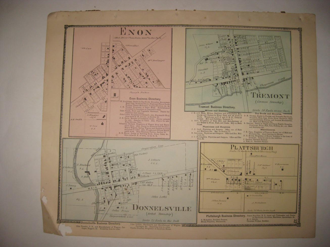
Vintage antique 1870 handcolored map, very rare antique 1870 map. The map shows Enon, Tremont, Donnelsville, and Plattsburgh. Some minor loss at extreme lower left hand side, if framed would be fine. The map shows the named railroads, named land owners, size of land parcels, locations of buildings, named streets, and much more of this period. The map is printed on thick paper with no printing on reverse. This is an antique map and not a reprint or reproduction. The handcoloring on the map is period to the map, this is before color printing. The map is from the very rare 1870 Titus Atlas of Clarke County Ohio, Titus was one of the greatest mapmakers of this period . The map is a fascinating and historic period look at this area at this time. The photo wont show the full beauty of the map. The size of the map is 15" by 24". Winning bidder pays $4.00 shipping domestic, more foreign.
Payment
I accept the following forms of payment:
- PayPal
Shipping & Handling
US Shipping |
International Shipping |
| FREE scheduling, supersized images and templates. Get Vendio Sales Manager. |
FREE scheduling, supersized images
and templates. Get Vendio Sales Manager.