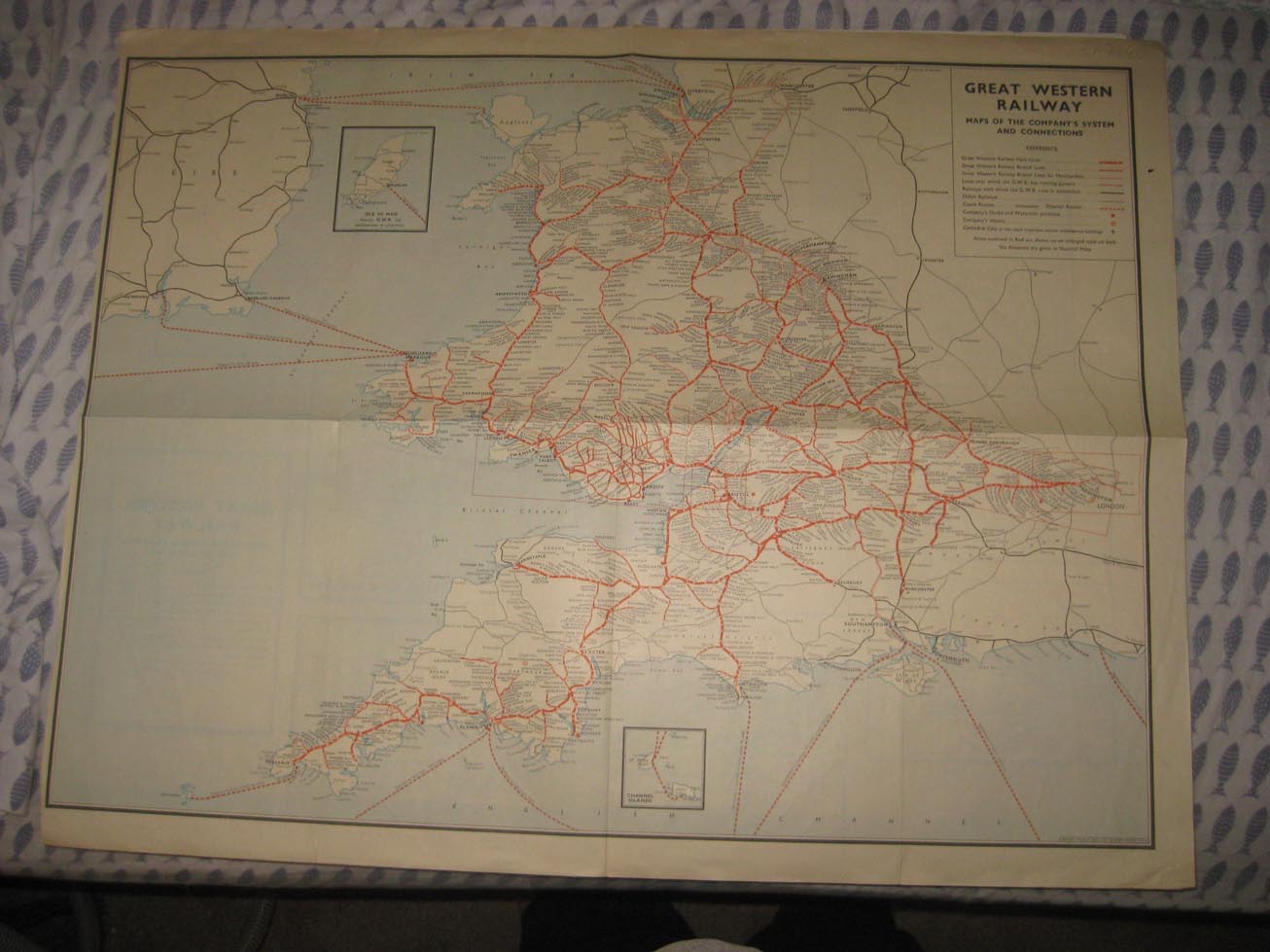
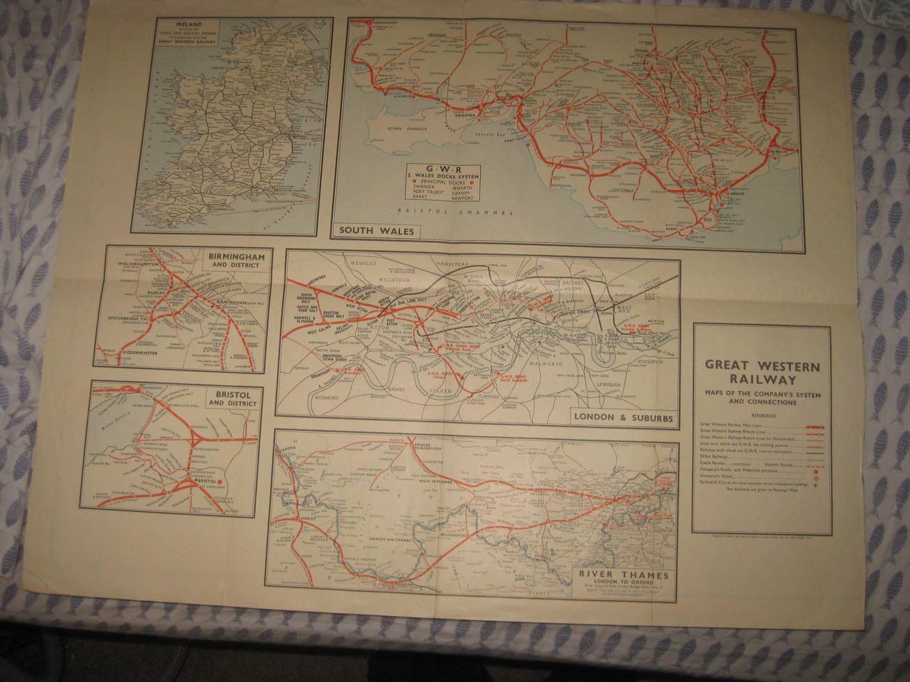
Rare, circa 1950s era antique 2 sided map, Great Western Railway. Both sides show fascianting railroad lines and much more. Small tear at bottom, about 1". One side is Ireland, London & Suburbs, River Thames, London to Oxford, Bristol and District, Birmingham and District, and G.W.R, S. Wles Dock System. Reverse is Great Western Railway, Maps of the Company'S System and Connections. Very detailed maps. The size of the map is 19.5" by 25". Rare. Winning bidder pays $3.75 shipping domestic, more foreign.
Payment
I accept the following forms of payment:
- PayPal
Shipping & Handling
US Shipping |
International Shipping |
| FREE scheduling, supersized images and templates. Get Vendio Sales Manager. |
FREE scheduling, supersized images
and templates. Get Vendio Sales Manager.