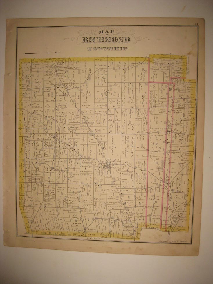
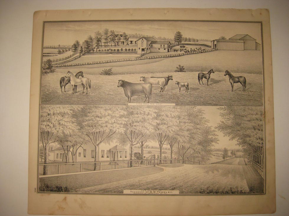
Vintage antique 1876 handcolored map. The map is printed on fine paper, and is 2 sided, either side would frame and display quite nicely, one side is Map of Richmond Township, the map is very detailed, with the named home and land owners, the roads, named railroads, size of land parcels, locations of buildings and much more. On reverse is a fine lithograph print page of Res of GW Townley, Richmond Twp. The handcoloring on the map is period to the map, this is before color printing. The map is from the very rare 1876 Caldwell Atlas of Crawford County Pennsylvania. The map is a fascinating and historic period look at this area at this time. The map shows the home and land owners, the business and industry, the few roads, railroads etc that existed at that time.The scans wont show all of the map, or the true beauty of this fine antique map. The map is in nice shape and would frame and display quite beautifully. The size of the map is 14" by 16.5". Winning bidder pays $4.50 shipping domestic, more foreign.
Payment
I accept the following forms of payment:
- PayPal
Shipping & Handling
US Shipping |
International Shipping |
| FREE scheduling, supersized images and templates. Get Vendio Sales Manager. |
FREE scheduling, supersized images
and templates. Get Vendio Sales Manager.