1771 Bonne Map of Burgundy, Franche-Comte, and Lyonnais, France 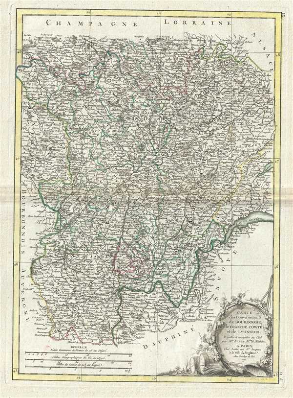 WE SELL ONLY ORIGINAL ANTIQUE MAPS - NOT REPRODUCTIONS Title: Carte des Gouvernements de Bourgogne, de Franche Comte et de Lyonnois. Description: This is an attractive example of Rigobert Bonne's 1771 decorative map of the French winemaking region of Burgundy, and the adjacent regions of Franche-Comte and Lyonnais. Covers the region in full from Champagne to Dauphine and from Auvergne to Savoy. This region is famed for producing the world's finest wines. A large decorative title cartouche appears in the lower right quadrant. Drawn by R. Bonne in 1771 for issue as plate no. H 5 in Jean Lattre's Atlas Moderne. Size: Printed area measures 16.5 inches high by 12 inches wide. Condition: Very good. Some toning and wear along original centerfold. Minor foxing. Original platemark visible. Items are shipped within three business days of receiving payment. 1. USA Only. Signature Required. Customs: International buyers are responsible for paying duty and taxes on delivery. DHL or FedEx will contact the buyer by telephone to arrange tax payment if it is levied. Duty varies by country and we cannot predict the amount you will be charged. Some countries are duty free, others are not. Typically, a customs duty and/or VAT tax will be assessed on all parcels to continental Europe. Sometimes duty or tax is due in China, but is seems very random. Hong Kong, Singapore, Korea, and Taiwan have never assessed duty on a map we shipped. Maps shipped to the UK should be duty free as educational materials, but from time to time duty of 5% is assessed incorrectly by the UK customs agents. Insurance: All shipments are insured privately against loss and damage. All of our shipments require a signature for insurance purposes. If you have any questions please feel free to email us through eBay. Other Services Conservation Framing: Geographicus recommends basic conservation framing services for any antique paper. We do not offer this service. |
