

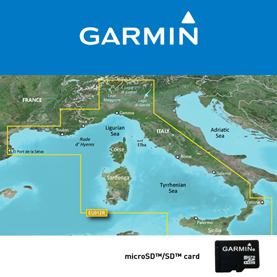
GARMIN Bluechart G3 Vision HD MEDITERRANEO CENTRALE VEU012R art. 010-C0770-00
SPECIFICHE ARTICOLO
Codice produttore: 010-C0770-00
Codice EAN: 0753759069506
GARANZIA
RIVENDITORE AUTORIZZATO

GARANZIA 24 MESI
DESCRIZIONE
Questi prodotti cartografici contengono cartografia nautica dettagliata su scheda pre-programmata, e possono essere utilizzati su qualsiasi unità GPS compatibile. Le schede vengono fornite nel formato microSD + adattatore SD card.
Per la copertura delle singole schede, consultare https://maps.garmin.com/it-IT/marine
Per le differenze tra g2 HD e g2 Vision HD consultare GARMIN Official
La cartografia ad alta precisione BlueChart g2 Vision consente di ottimizzare ulteriormente la vostra navigazione grazie alle sue caratteristiche avanzate quali: immagini satellitari ad alta risoluzione, viste prospettiche e visualizzazione in 3D sopra e sotto il livello del mare, tecnologia Auto Guidance per il calcolo automatico della rotta, foto aeree di porti, baie e marine, nonché di idrovie e strade costiere con punti di interesse.
Caratteristiche
- Visualizzazione cartografia in modo continuo (seamless)
- Dati vettoriali
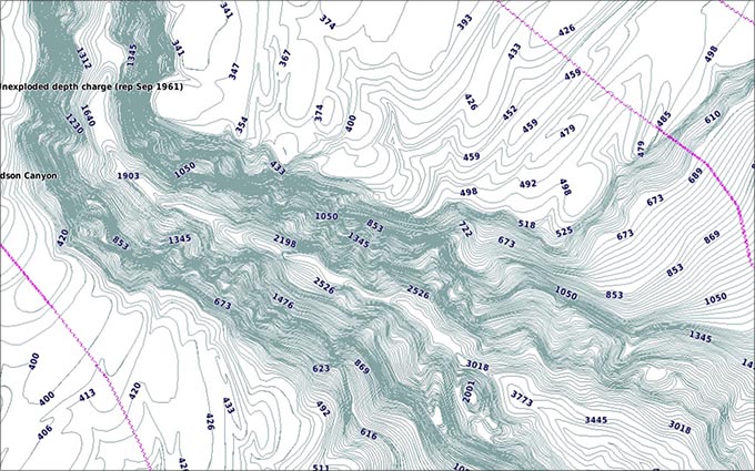
- Profili dei fondali ombreggiati con indicazioni della profondità
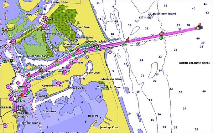
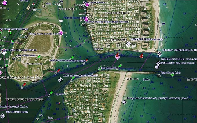
- Piani dei porti
- Indicazione dell’ampiezza di marea
- Ausili alla navigazione con copertura e intervallo di visualizzazione incluse le informazioni relative ai settori dei fari
- Relitti, aree non navigabili, ancoraggi, ostruzioni
- Indicazione grafica delle correnti di marea
- Visualizzazione 2D o 3D
- Marine e scali di alaggio
- Batimetriche con profilo dettagliato dei fondali
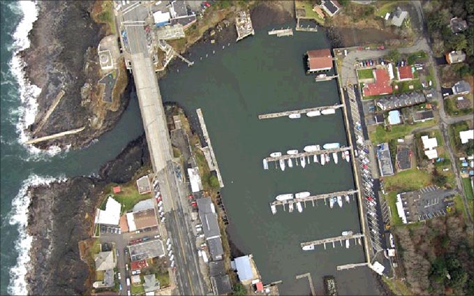
- Foto aeree a colori di porti, marine, ponti e punti cospicui
- Dettaglio stradale fino a cinque miglia dalla costa
- Punti di interesse: ristoranti, alloggi, divertimenti e altro
- Immagini satellitari realistiche ad alta risoluzione
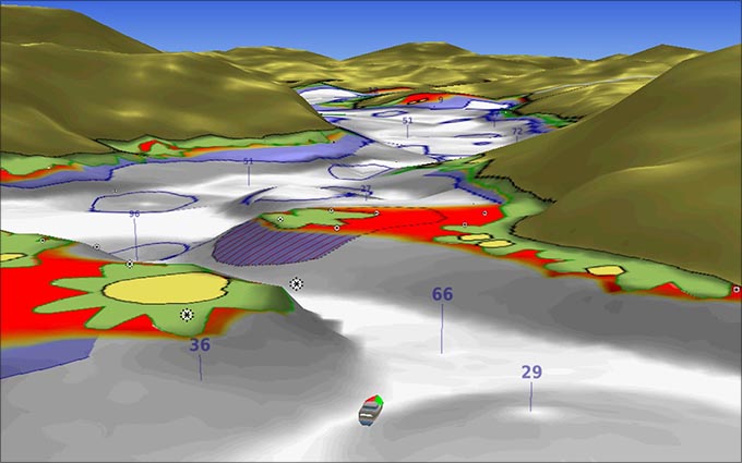
- Visualizzazione immagini 3D in prospettiva “Mariner’s eye” - sopra la superficie dell'acqua
- Visualizzazione immagini 3D in prospettiva “Fish eye” - sotto la superficie dell'acqua
- Tecnologia Auto Guidance per la pianificazione della migliore rotta
- Sovrapposizione grafica delle correnti di marea
Auto Guidance¹
Auto Guidance technology quickly calculates a suggested route using your boat's dimensions and a suggested path to follow.
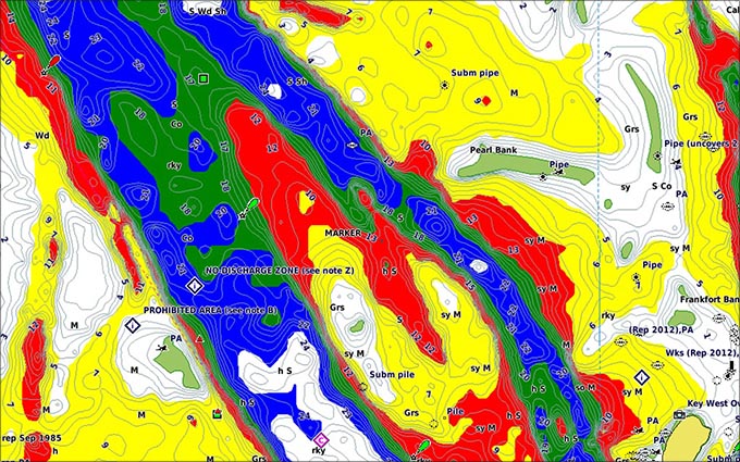
Depth Range Shading
Displays high-resolution Depth Range Shading for up to 10 depth ranges so you can view your designated target depth.
Detailed Contours
BlueChart g2 Vision HD features 1-foot contours that provide a more accurate depiction of bottom structure for improved fishing charts and enhanced detail in swamps, canals and port plans.
MarinerEye View
Provides a 3-D representation of the ocean floor as seen from below the waterline.
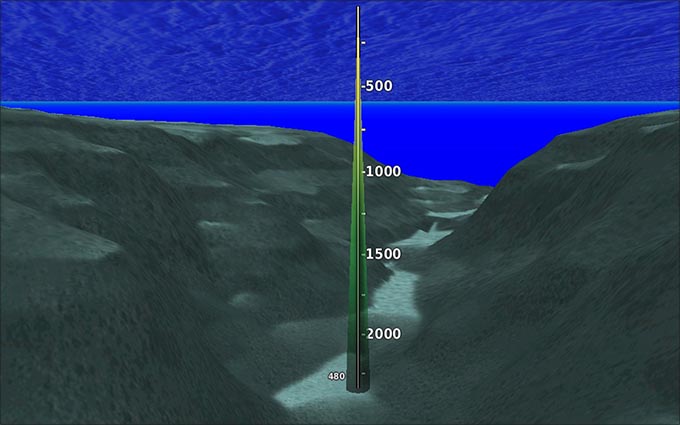
FishEye View
Provides a 3-D representation of the surrounding area both above and below the waterline.
High-resolution Satellite Imagery
High-resolution satellite imagery with navigational charts overlaid gives you a realistic view of your surroundings so you can navigate with a clear moving-chart representation of your boat’s position. It’s our most realistic charting display in a chartplotter.
Aerial Photography
Crystal clear aerial photography shows exceptional detail of many ports, harbors and marinas and is ideal when entering unfamiliar ports.

FEEDBACK
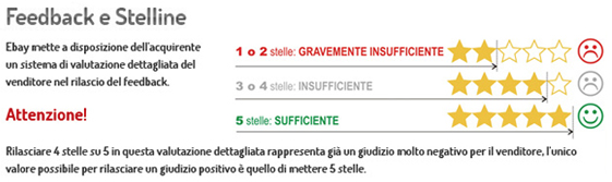
Vi preghiamo di fare particolare attenzione al sistema di valutazione dei FEEDBACK. Una valutazione con meno di 5 stelle viene considerata da eBay come insufficente. Pertanto vi invitiamo a contattarci tempestivamente per qualsiasi problema prima di procedere nella valutazione. Saremo sempre disponibili a risolvere qualsiasi vostra esigenza.
PAGAMENTI

Acquista in tutta sicurezza attraverso il programma di protezione clienti PayPal oppure, se preferisci, puoi effettuare il pagamento mediante bonifico bancario o contrassegno (se previsto nell' inserzione). I dati completi verranno visualizzati subito dopo l'acquisto, una volta scelto come metodo di pagamento il bonifico bancario. Per qualsiasi info non esitate a contattarci
SPEDIZIONE

Al momento dell'arrivo del prodotto, il cliente ha l'obbligo di controllare l'imballo e se presenta segni di rottura o manomissione, è autorizzato a rifiutare la spedizione e scrivere nelle note della bolla di accompagnamento del corriere che non viene accettato causa danneggiamento durante il trasporto.
