 |  |  | ||||||||||
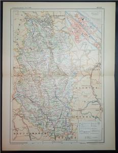
 | 1897 FOLDING COLOUR MAP OF Overall Size Approx: 39 x 30 cm Paypal, UK Cheques/Postal Orders, Bank Transfer. MULTIPLE PURCHASES AND COMBINED SHIPPING: Wherever possible multiple purchases will be combined into one parcel in order to reduce shipping costs. Please wait for an invoice to be sent before making payment. FEEDBACK: Please note, feedback will always be left after it has been received from buyers. Thank you for your interest and please remember to take a look at my other items. New items are added regularly, so please check again soon. | | ||||||||||
 |  |  | ||||||||||
| Save time & money with FREE Auctiva Image Hosting. |

Auctiva,
The complete eBay Selling Solution.