USPS 1st Class USPS Priority Mail USPS 1st Class International
Combined Shipping is available
Return Policy
We stand behind the quality of every print we sell. If you aren't satisfied with your purchase, contact us within 60 days to arrange for an exchange or a full refund.
About Us
Artscape Galleries is a family owned business based in Las Vegas, Nevada. We have been selling art prints exclusively online for over 15 years. With thousands of satisfied buyers ranging from Movie Studios to Museums, you will not be disappointed!
Please vist our other eBay store!
Feedback
“Impressed! Vibrant colours, edge to edge print. Very excited to get it framed!”
“Super fast delivery and the colors are amazingly rich. Thanks for everything!”
“Terrific experience with this seller, we buy more from him than anyone on Ebay!”
“WOW! Beautiful map! Lightning fast shipping, Very well packed, Great eBayerA++++”
“Vibrant and bright! Pic does not do it justice...looks amazing!”
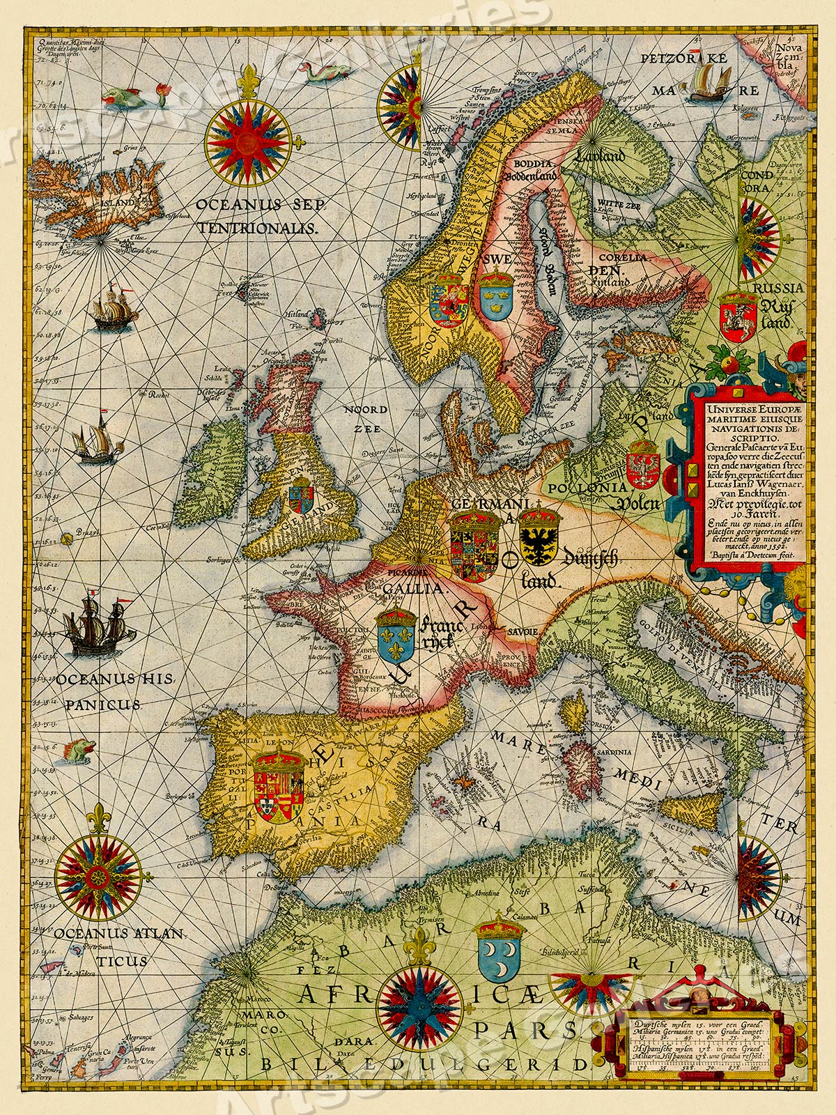
Universe Europae Maritime Eiusque Navigationis Descritio (General Sea Chart of Europe)
Year: 1583
Size: 20"x28"
An extremely striking map, considered to be the earliest printed sea chart
of Europe. This chart covers all of Europe, the British Isles, Iceland, the
Western Mediterranean, North Africa and the Wester Atlantic Ocean. This
richly embellished map also features the royal coat of arms of each land.
This Classic Vintage Style poster honors the beauty of this unique art form and evokes the vivid images of simpler times. Each of our prints are custom reproductions printed on 68lb Heavyweight Enhanced Matte Art Paper. These Historic Art Prints are suitable for framing, mounting or direct display on any wall!
Graphics and template design by and copyright Artscape Galleries / Posters Past MAP157