
1929 Press Photo Newsmap highlighting the United States air transport routes
ago, the airway system of the United States has expanded until the air trans- port companies flying with mail, express and passengers are flying more than 40,000 miles a day over the airways pictures in this map of the American Air Transport Association lines on this map represent air routes totaling 21,000 miles, over which mail-passenger and passenger planes shuttle back and forth daily a distance one and three-quarters times the mileage around the globe. Within the next few months, when new services, for which equipment has already been bought, get into operation daily mileage flown will be in excess of 50,000 miles... Photo measures 10 x 8 inches. Photo Is dated 1929.
PHOTO FRONT
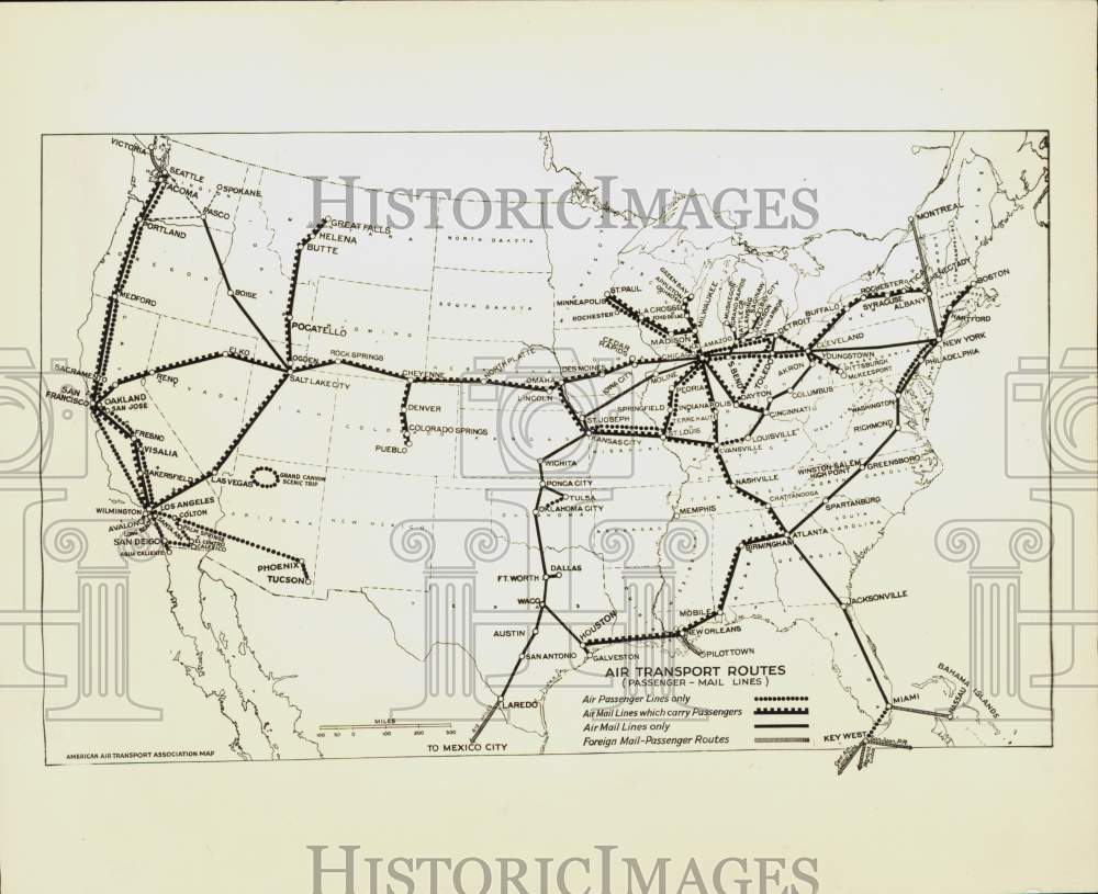
PHOTO BACK
Historic Images Part Number: nei50593