
1947 Press Photo Map shows how superbombers from Presque Isle can range world
Large map above shows how Army's atom-bomb-carrying B-29's and still more powerful B-36 superbombers could fan out over the top of the world to far-off points in Europe, Asia and Africa from the projected $14,000,000 Air Forces base 30 miles northwest of Presque Isle, in Aroostook County, Maine. Lower map shows close-up of the site, strategically located for planes to attack any of the great industrial centers of the world. It is also astride the shortest European U.S. aerial invasion route down the St. Lawrence valley. AAF says construction will begin about June 15 and may be completed by fall, 1948. B-29's have a range of 6500 miles and B-36's a range of 10,000 miles. General Carl Spaatz, AAF commander, foresees 13,000-mile-range planes in a few years. Photo measures 6.75 x 8.75 inches. Photo Is dated 1947.
PHOTO FRONT
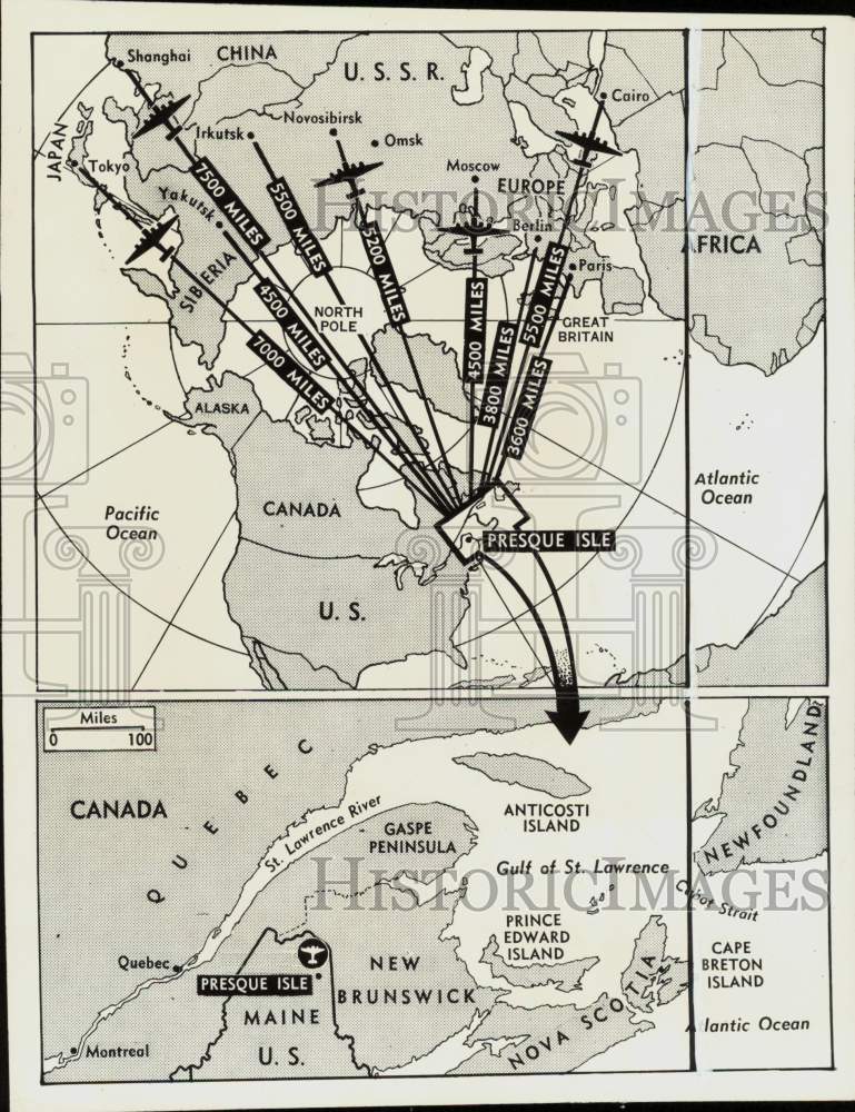
PHOTO BACK
Historic Images Part Number: nei50493