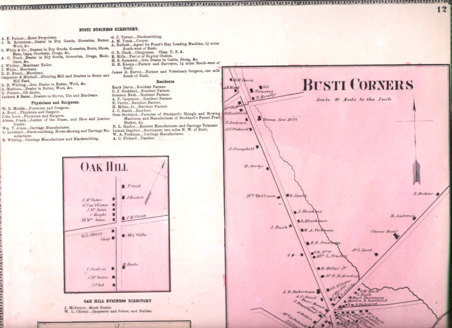
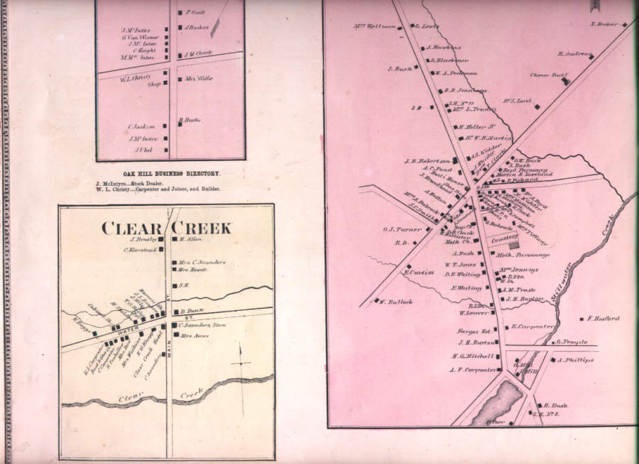
Vintage antique 1867 handcolored map. The map is titled Busti Corners, Oak Hill and Clear Creek. This is an antique map and not a reprint or reproduction. I dont like or sell reproductions. The handcoloring on the map is period to the map, this is before color printing. The map is from the very rare 1867 Beers Atlas of Chautauqua County New York. The map is a fascinating and historic period look at this area at this time. The map shows the home and land owners, the business and industry, the few roads, railroads etc that existed at that time.The scans wont show all of the map, or the true beauty of this fine antique map. The map is in nice shape and would frame and display quite beautifully. The size of the map is 13" by 15". Winning bidder pays $3.75 shipping domestic, more foreign.
Payment
I accept the following forms of payment:
- PayPal
Preferred Checkout
Shipping & Handling
$3.75 USPS
| FREE image hosting (including supersized) with Vendio Sales Manager. |
Listing automation and FREE scheduled listings by Vendio.
