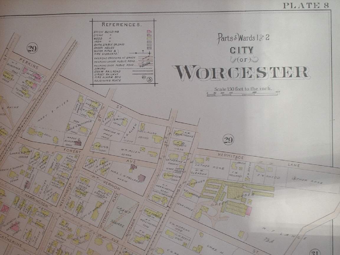
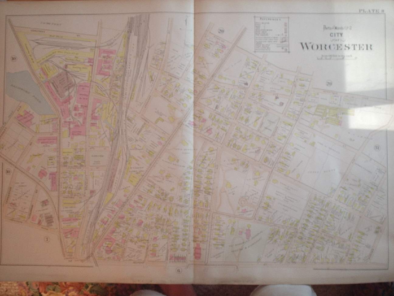
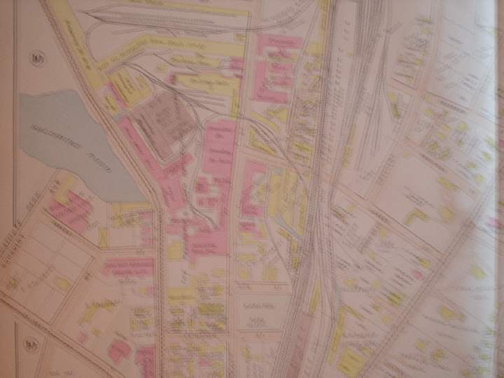
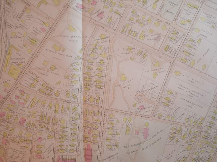
Rare, large, superb, vintage 1896 handcolored map, Worcester Massachusetts. The condition is excellent, would frame and display beautifully. The map is titled upper right hand side, Parts of Wards 1 & 2 City of Worcestor,(I like how the title is right on the map, so you know eaxctly what this is, if framed or displayed) with references chart below that, showing what each building etc is made out. This is a vintage antique fine handcolored map, printed on thick, beautiful paper. From the very rare 1896 L.J. Richards Atlas of Worcester Massachusetts. Its not a reproduction or copy. The map is an amazing and important historical snapshot of Worcester at this time. Has Worcester Gasl Light Co. Electric Company , Annealing House , foundry , lumber yard, mansions, large railroad areas, names mills, named churches, named huge industry and much more. It shows the land owners, and amazing business and industry going on then. It also shows how each house or building is made, what it is constructed of. My scans wont show the full beauty of the map, or even all of the map. There are some amazing areas on this map, many business and industry, huge industry, railroad lines , mansions, large railroad areas , trolley lines and much more. Map is in nice shape, beautiful condition, would frame and display quite nicely. The size is 22" by 32", great size. Winning bidder pays $3.75 shipping domestic ,more foreign.
Payment
I accept the following forms of payment:
- PayPal
Preferred Checkout

Shipping & Handling
$3.75 USPS
| FREE image hosting (including supersized) with Vendio Sales Manager. |
Listing automation and FREE scheduled listings by Vendio.
