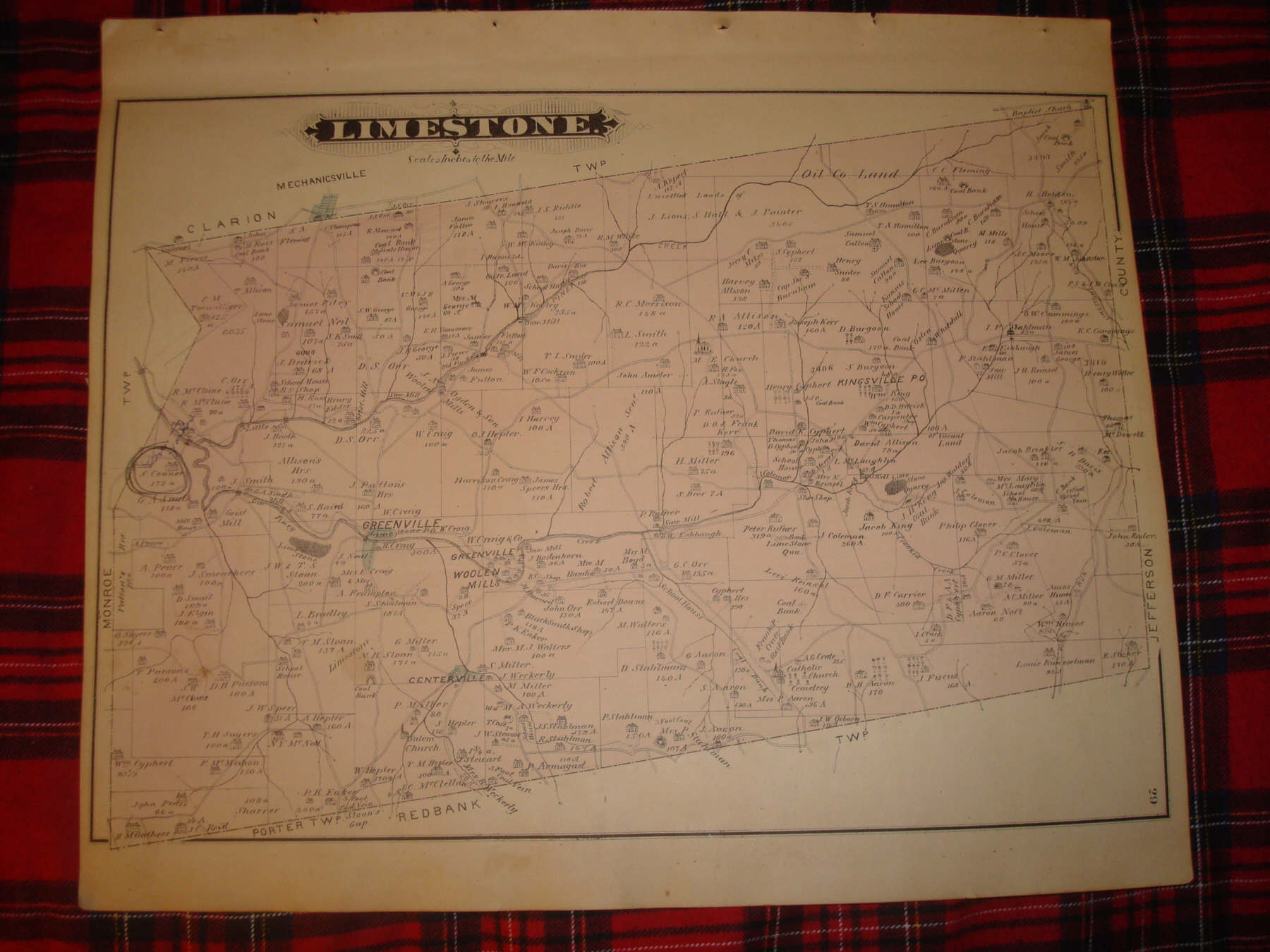
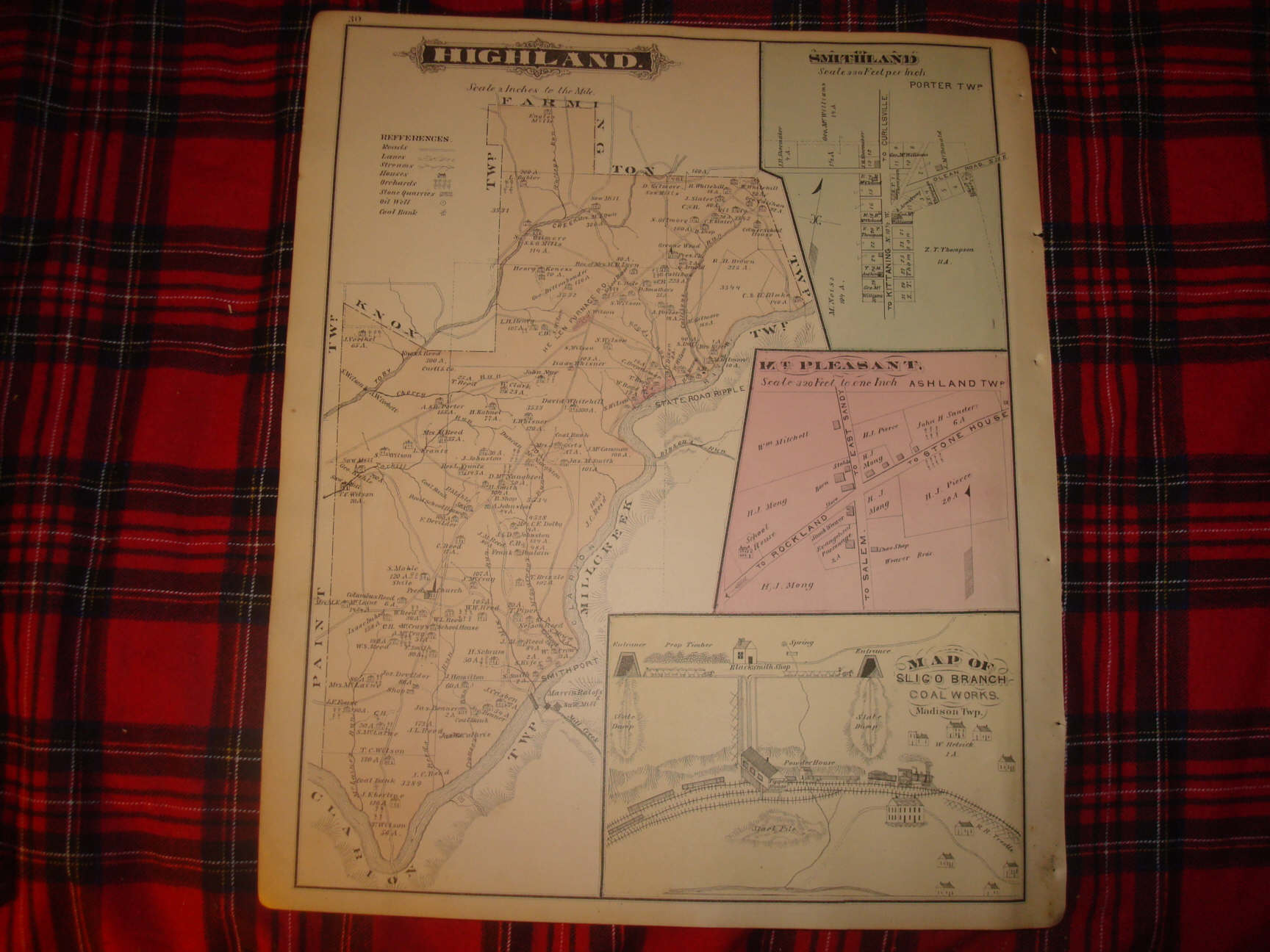
ANY UNUSUAL SHADOWS ARE ON THE PHOTO ONLY, THE MAP IS IN EXCELLENT CONDITION. Vintage antique 1877 handcolored map, and also superb and extremely rare handcolored lithograph prints. The map is 2 sided, and either side would frame nicely. One side is Highland , this is Highland Township , I see State Road Ripple , and more. On right hand side are inset maps of Smithland , Porter Township , Mt Pleasant Ashland Twp and Map of Sligo Branch Coal Works , very detailed coal mining images. Verso is Limestone Township , I see Greenville , Centerville , Kingsville Po and mor. Map has some chips lower right hand side, and a tear there. This is an antique map and not a reprint or reproduction. The handcoloring on the map is period to the map, this is before color printing. The map is from the very rare 1877 Caldwell Atlas of Clarion County Pennsylvania. The map is a fascinating and historic period look at this area at this time. The map shows the home and land owners, the business and industry, the few roads, railroads etc that existed at that time. The photos wont show the full beauty of the map. The size of the map is 14.5" by 17". Winning bidder pays $3.75 shipping domestic, more foreign.
Payment
I accept the following forms of payment:
- PayPal
Preferred Checkout
Shipping & Handling
$3.75 USPS First-Class Mail®
| FREE scheduling, supersized images and templates. Get Vendio Sales Manager. |
FREE scheduling, supersized images
and templates. Get Vendio Sales Manager.
