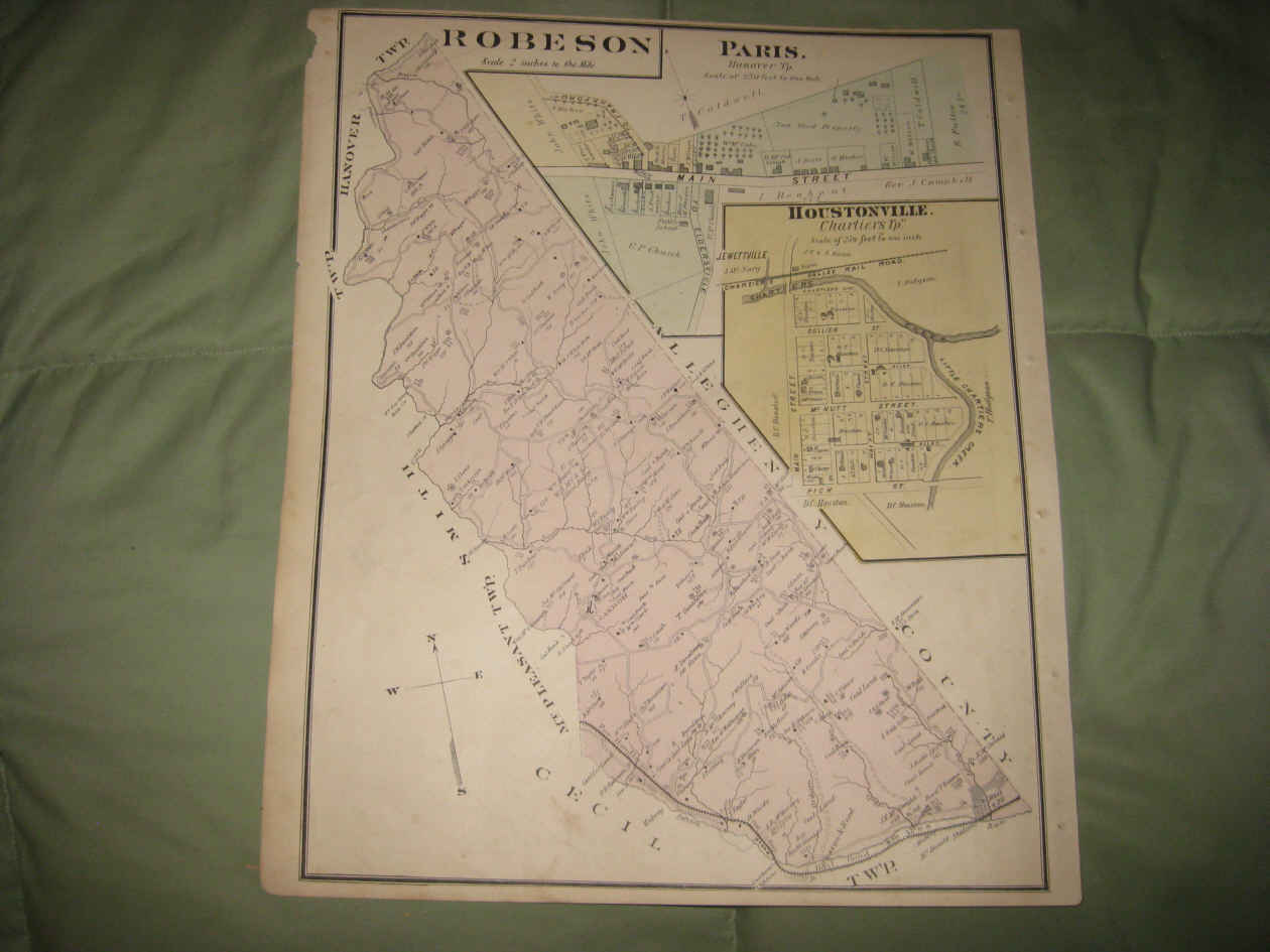
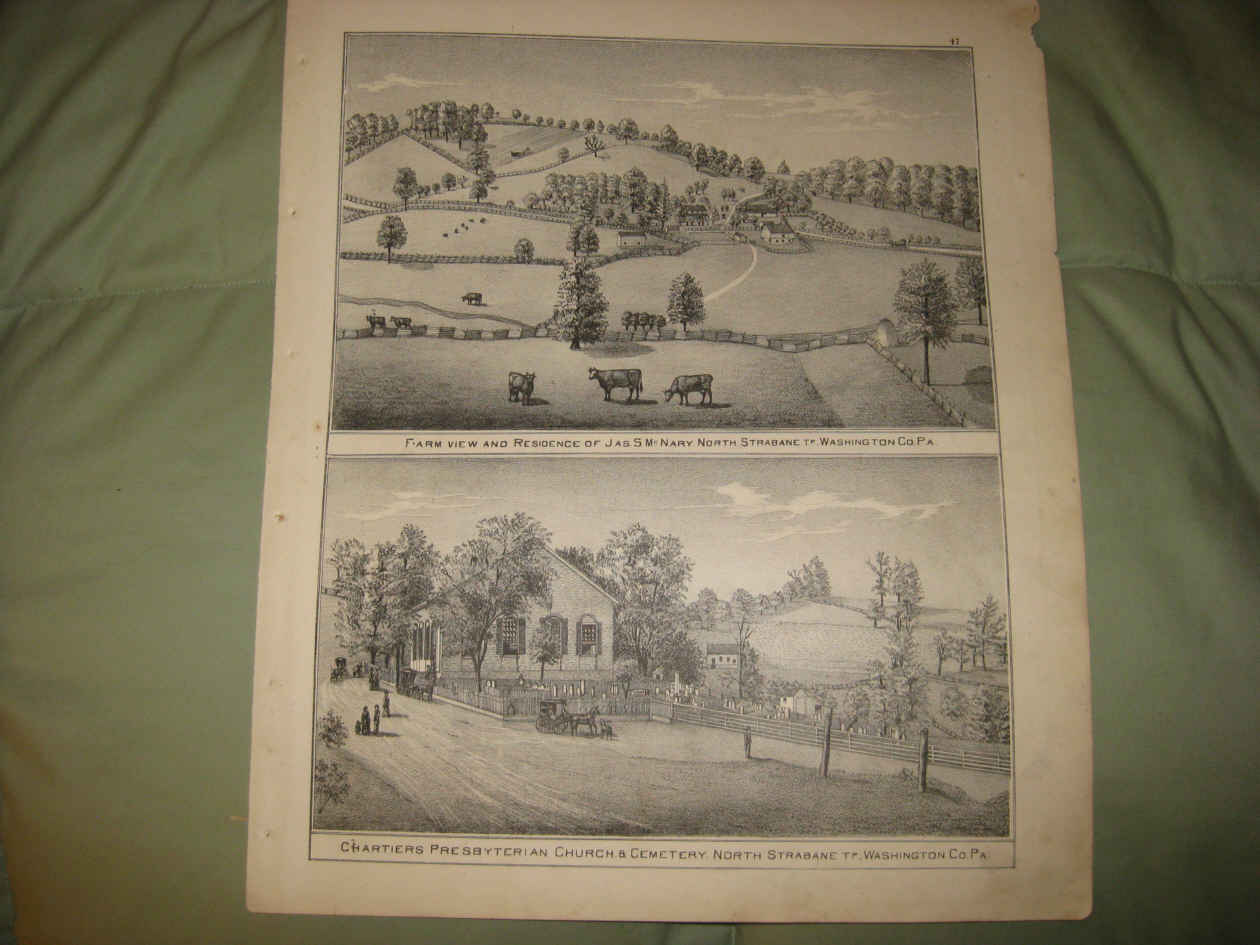
Vintage antique 1876 handcolored map. The map is 2 sided and either side would frame and display nicely. On one side is Robeson , this is Robeson Township, and at right is Paris, Hanover Township and Houstonville, Charties Twp. The maps are very detailed, showing the named home and land owners, named railroads, location of buildings, and much more. Verso is a gorgeous period lithograph, showing 2 fine North Strabane Township views, top is Farm View and Rwes of Jas McNary, and bottom is Chartiers Presbyterian Church & Cemetery, North Strabane Twp. The map is printed on thick fine paper. This is an antique map and not a reprint or reproduction. The handcoloring on the map is period to the map, this is before color printing. The map is from the very rare 1876 Caldwell Atlas of Washington County Pennsylvania . The map is a fascinating and historic period look at this area at this time. The map is in nice shape and would frame and display quite beautifully. The size of the map is 14.5" by 17". Winning bidder pays $3.75 shipping domestic, more foreign.
Payment
I accept the following forms of payment:
- PayPal
Shipping & Handling
US Shipping |
International Shipping |
| FREE scheduling, supersized images and templates. Get Vendio Sales Manager. |
FREE scheduling, supersized images
and templates. Get Vendio Sales Manager.