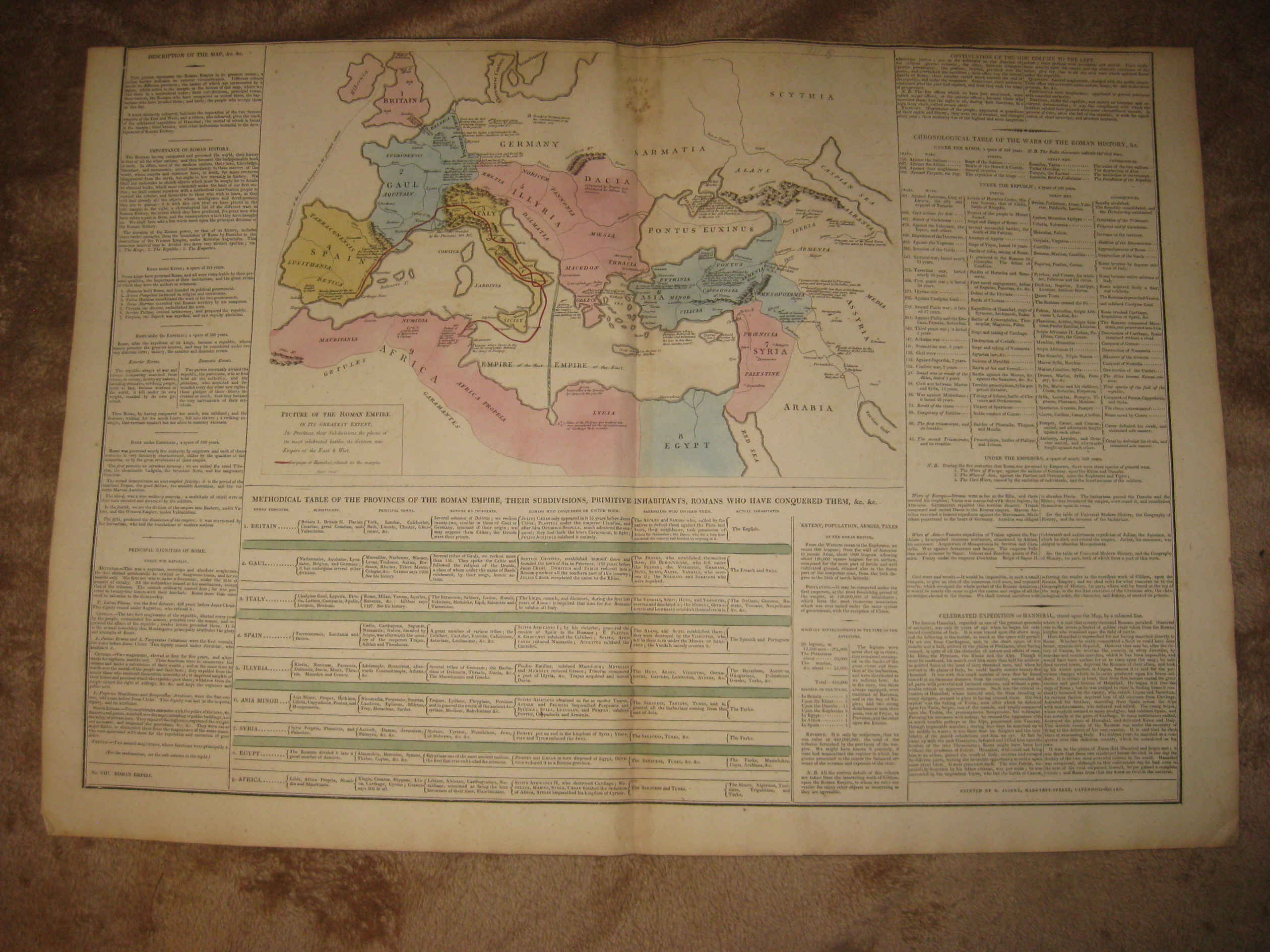
Huge, gorgeous, very fine, antique handcolored 1818 map, titled Picture of the Roman Empire, In Its Greatest Extent, with more text. very finely detailed Roman Empire large format map. Very detailed text on the map itself, and also at bottom and sides, fascianting detialed text. The map is printed on very thick fine paper, I believe fine period handmade paper, no printing on reverse. The map is from the rare and important Le Sage Historical, Genealogical, Chronological and Geological Atlas, published in London in 1818. Printed at bottom is Printed by J. Juigne, 17 Margaret St. Cavendish-Square. The size of the map is a large 19" by 27.5". The map is in very fine condition. Beautiful and rare period map. Winning bidder pays $5.00 shipping domestic, more foreign.
Payment
I accept the following forms of payment:
- PayPal
Shipping & Handling
US Shipping |
International Shipping |
| FREE scheduling, supersized images and templates. Get Vendio Sales Manager. |
FREE scheduling, supersized images
and templates. Get Vendio Sales Manager.