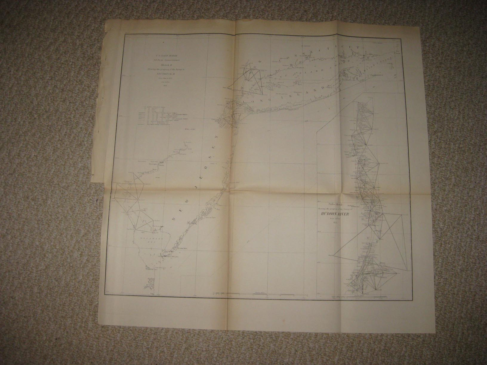
Rare, fine, early antique 1855 map, titled U.S. Coast Survey, Sketch B, Showing the Progress of the Survey in Section No. 11 from 1844 to 1855, then dated 1855, this dates them ap nicel, the map shows the New Jersey coast and Long Island, at right is a fine inset map titled Sub-Sketch, Showing the Progress of the Survey of Hudson River, 1855, also a fine period map. The map is in excellent condition, and would frame and display beautifully. The size of the map is 19.5" by 20". Rare. Winning bidder pays $3.75 shipping domestic, more foreign.
Payment
I accept the following forms of payment:
- PayPal
Shipping & Handling
US Shipping |
International Shipping |
| FREE scheduling, supersized images and templates. Get Vendio Sales Manager. |
FREE scheduling, supersized images
and templates. Get Vendio Sales Manager.