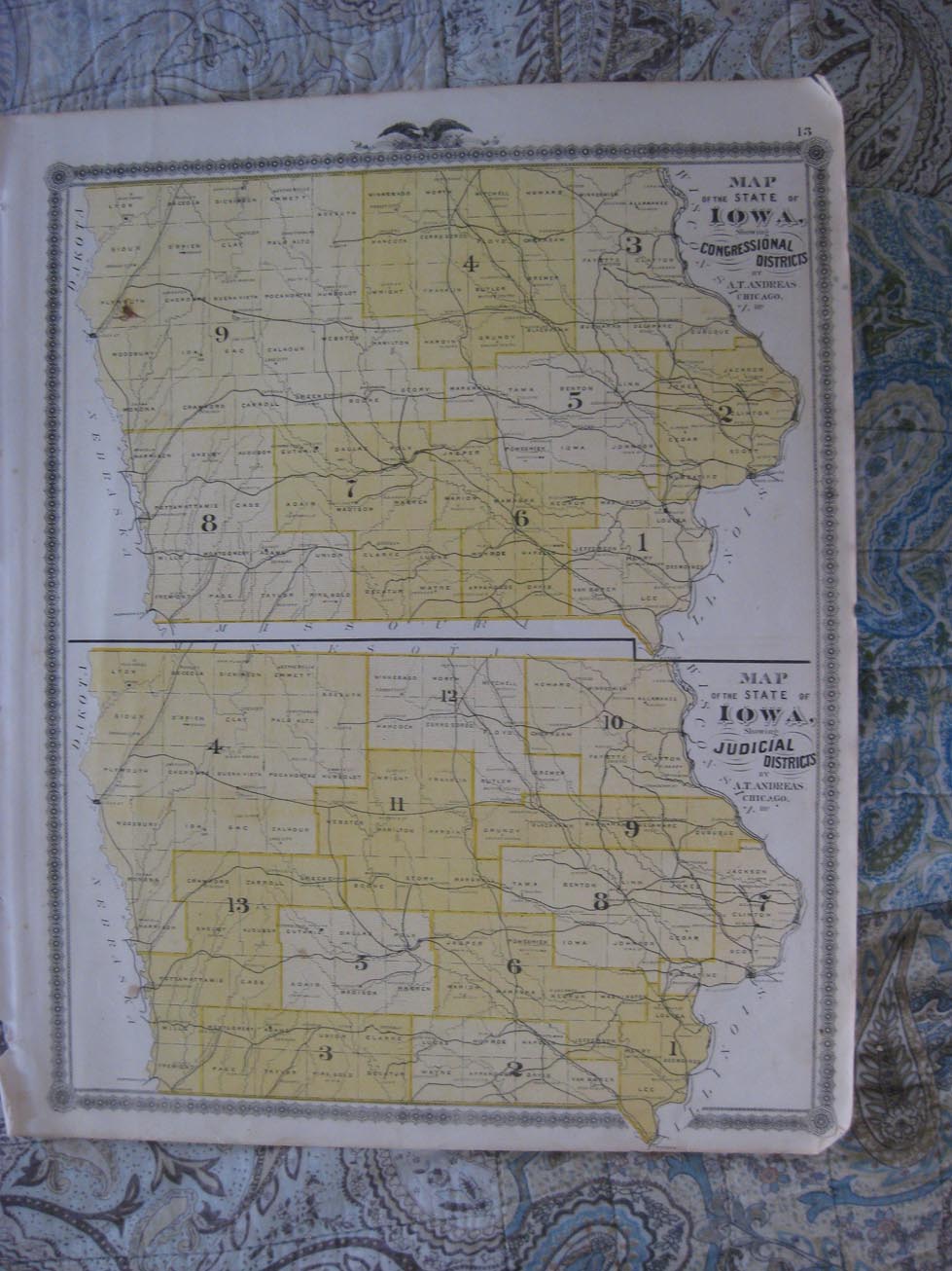
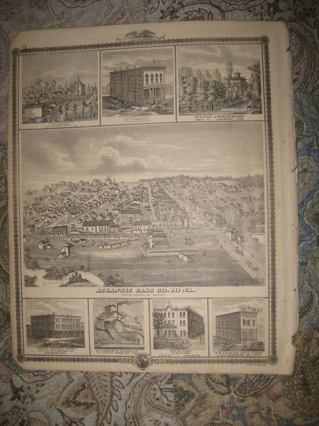
Vintage antique 1875 map. The map is 2 sided and either side would frame and display nicely. One side is a fine antique map titled Map of the State of Iowa Showing Congressional Districts, and Map of the State of Iowa Showing Judicial Districts. Verso is a very fine antique lithograph print page, shwoing several fascianting Iowa views, in the middle is Atlantic, Cass County, Iowa, From North of Depot, at top is Washington Township , Atlantic, and Davenport, bottom is Davenport , Altoona, Chariton and Albia. The condition is just amazing, beautiful topflight condition. Very finely produced map, printed on thick fine paper. This is an antique map and not a reprint or reproduction. The map is from the very rare 1875 Andreas Illustrated Historical Atlas of the State of Iowa. The map is a fascinating and historic period look at this area at this time. The photo wont show the full beauty of the map. The map is in nice shape and would frame and display quite beautifully. The size of the map is 14.5" by 17.5". Winning bidder pays $3.75 shipping domestic, more foreign
Payment
I accept the following forms of payment:
- PayPal
Shipping & Handling
US Shipping |
International Shipping |
| FREE scheduling, supersized images and templates. Get Vendio Sales Manager. |
FREE scheduling, supersized images
and templates. Get Vendio Sales Manager.