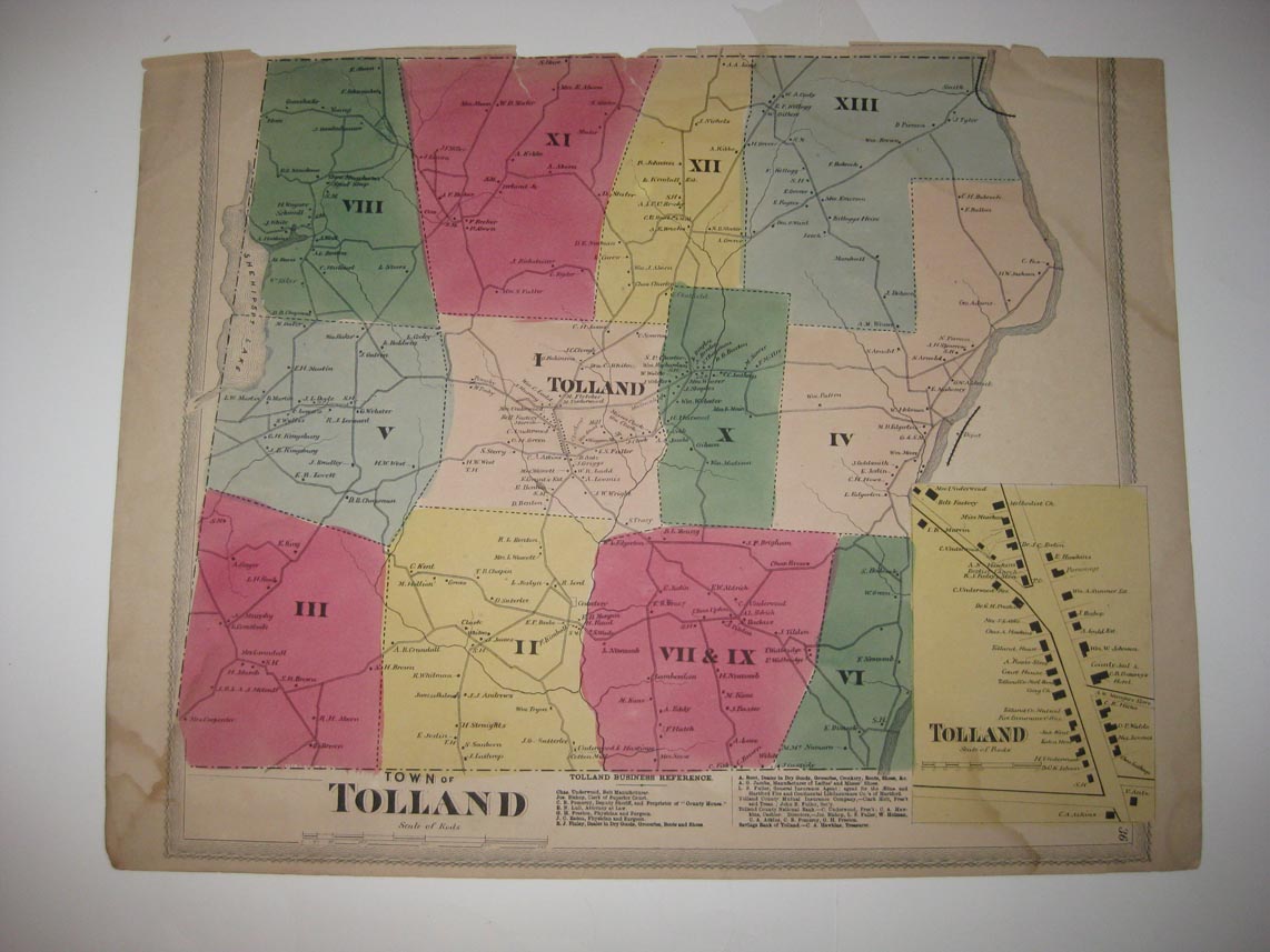
Vintage antique 1869 handcolored map. The map is titled Town of Tolland, with inset map of Tolland. The map has a light stain at bottom, much is lost in the map and some at upper right hand side, the map has a bit of loss at extreme top middle and a few small clean tears there, can be repaired. Many fascianting, detailed areas. The map shows the home and land owners, size and locations of buildings, the business and industry, the few roads, railroads etc that existed at that time. This is an antique map and not a reprint or reproduction. Overall map is in nice condition. Very rare. The handcoloring on the map is period to the map, this is before color printing. The map is from the very rare 1869 C.G. Keeney Atlas of Windham and Tolland County Connecticut. The map is a fascinating and historic period look at this area at this time. The map is in nice shape and would frame and display quite beautifully. The size of the map is 14.5" by 18". Winning bidder pays $4.00 shipping domestic, more foreign.
Payment
I accept the following forms of payment:
- PayPal
Shipping & Handling
US Shipping |
International Shipping |
| FREE scheduling, supersized images and templates. Get Vendio Sales Manager. |
FREE scheduling, supersized images
and templates. Get Vendio Sales Manager.