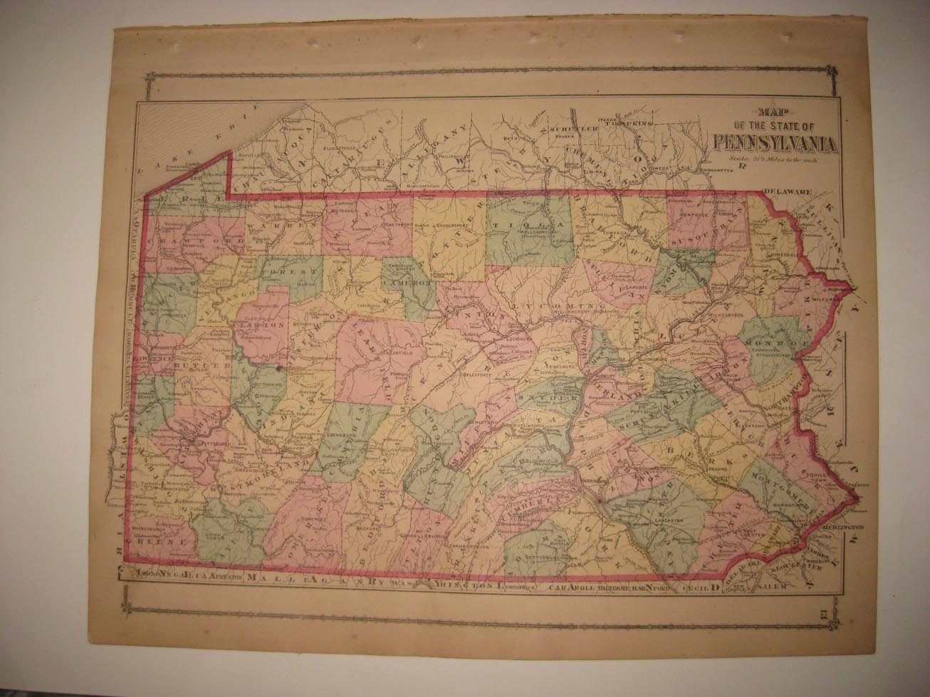
Rare, outstanding,vintage antique 1876 handcolored map . This is an antique map and not a reprint. The conditon of the map is excellent, just amazing condition. The superb handcoloring on the map is period to the map, this is before color printing. The map is titled, in fancy antique lettering, Map of the State of Pennsylvania. Fascianting, detailed and attractive period Pennsylvania, with the named railroads, cities, towns, villages and much more of this period. Has a light stain at extreme upper left hand side, and some at bottom middle. The map is printed on thick paper, with no printing on reverse. A fascianting and detailed period look at this area at this time. The map is from the rare 1876 Beers Atlas of Columbia and Montour Counties Pennsylvania. Very rare county atlas. The size of the map is 12" by 16". The photo wont show the true beauty of the map . Winning bidder pays $4.00 shipping domestic, more foreign.
Payment
I accept the following forms of payment:
- PayPal
Shipping & Handling
US Shipping |
International Shipping |
| FREE scheduling, supersized images and templates. Get Vendio Sales Manager. |
FREE scheduling, supersized images
and templates. Get Vendio Sales Manager.