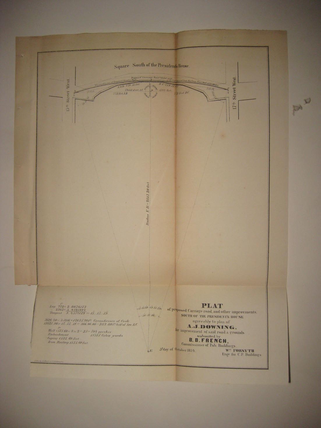
Rare, fine, early, antique 1854 map, titled Plat of Proposed Carriage Road and other Improvements South of the President's House aggreeably o plan of A.J. Downing for improvement of said road & grounds submitted by B.B. French, Commissioners of Pub. Buildings, 3d day of October 1854. This dates the map nicely. At top is Square South of the President's House. This is now called The White House. No printing on verso. The size of the map is 9.5" by 11.75". This would frame and display nicely. Winning bidder pays $3.25 shipping domestic, more foreign.
Payment
I accept the following forms of payment:
- PayPal
Shipping & Handling
US Shipping |
International Shipping |
| FREE scheduling, supersized images and templates. Get Vendio Sales Manager. |
FREE scheduling, supersized images
and templates. Get Vendio Sales Manager.