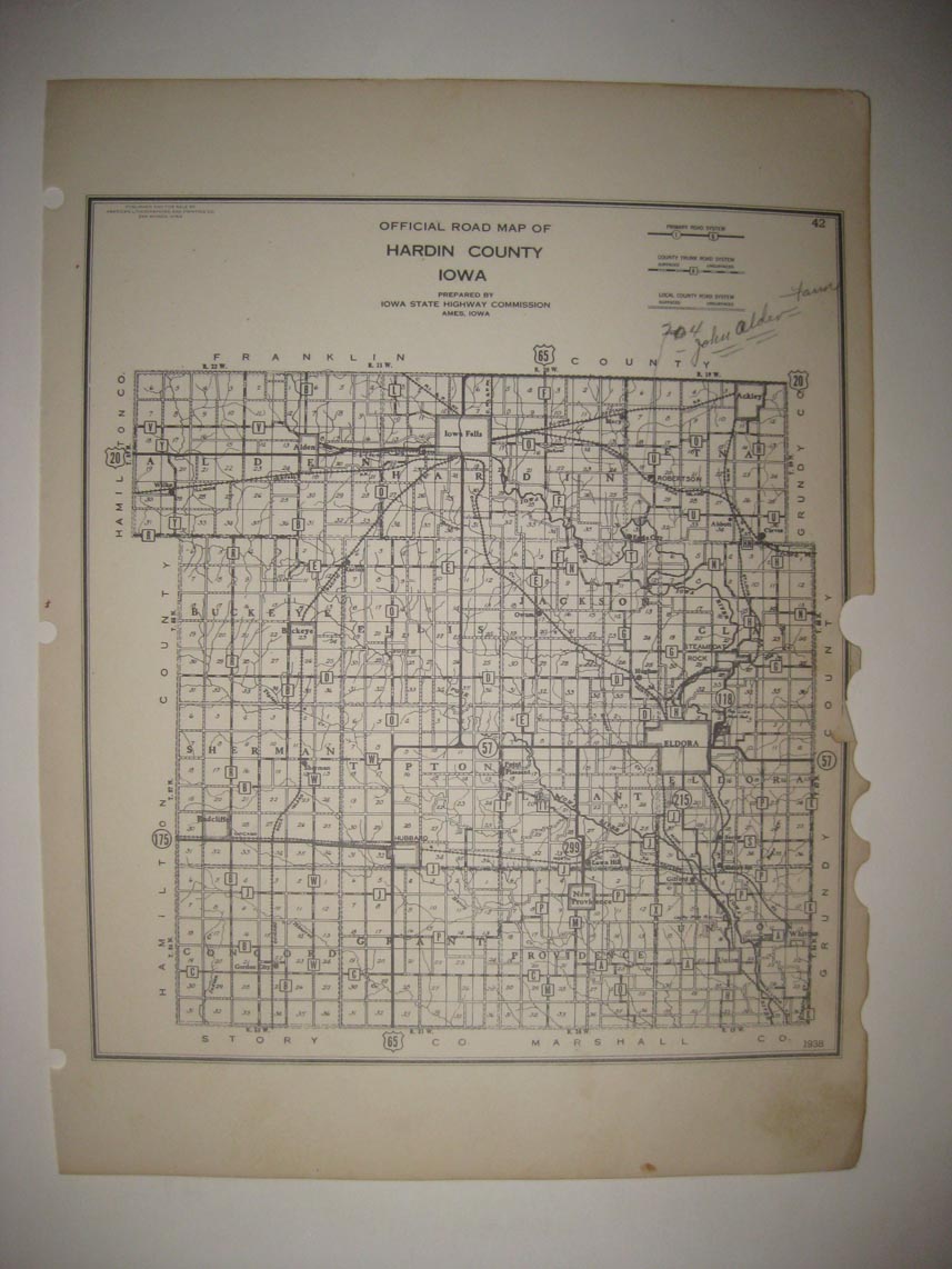
Rare, antique 1938 map, titled Official Road Map of Hardin County Iowa. At bottom right hand side has printed 1938, this dates the map nicely. There is a detailed chart with Primary Road System, County Trunk Road System, with Surfaced and Unsurfaced, and Local County Road System, also with Surfaced and Unsurfaced. Interesting and detailed period road and highway map of this county. There is no printing on reverse. This would frame and display quite nicely. The size of the map is 8.25" by 11". No printing on reverse. Winning bidder pays $3.25 shipping domestic, more foreign.
Payment
I accept the following forms of payment:
- PayPal
Shipping & Handling
US Shipping |
International Shipping |
| FREE scheduling, supersized images and templates. Get Vendio Sales Manager. |
FREE scheduling, supersized images
and templates. Get Vendio Sales Manager.