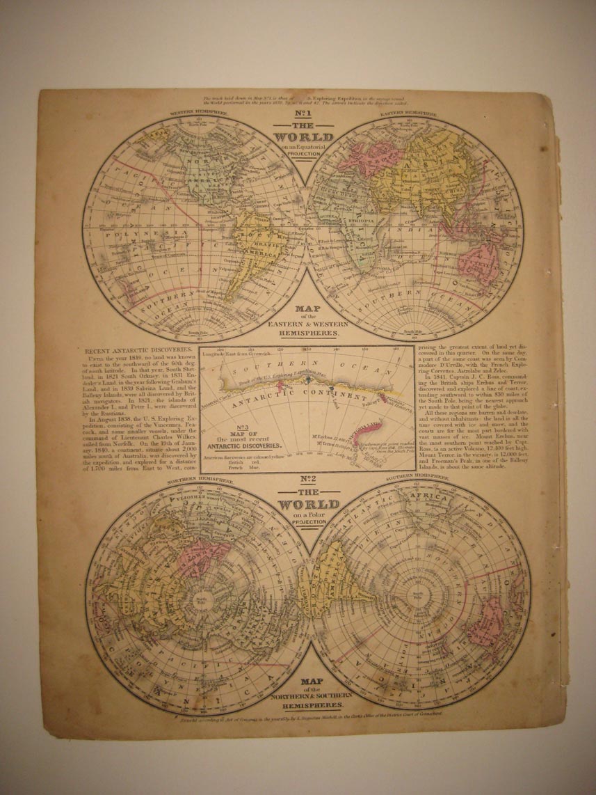
Superb, vintage antique 1839 handcolored map, titled The World on an Eqatorial Projection, Map of the Eastern and Western Hemisphere, The World on a Polar Projection, with Mpa of the Northern & Southern Hemispheres and Map of the most recent Antarctic Discoveries, with detailed text as well. Printed at lower left hand side is an 1839 copyright to S. Augustus Mitchell, this dates the map nicely. Fine and detailed map of the hemispheres at this time. Superbly printed on thick fine paper, with no printing on verso. The gorgeous delicate handcoloring is period to the map, this is before color printing. The map is in nice condition. The size of the map is 9.5" by 12". Rare. Winning bidder pays $3.65 shipping domestic more foreign.
Payment
I accept the following forms of payment:
- PayPal
Shipping & Handling
US Shipping |
International Shipping |
| FREE scheduling, supersized images and templates. Get Vendio Sales Manager. |
FREE scheduling, supersized images
and templates. Get Vendio Sales Manager.