'Potomac river sheet No. 1 from entrance to piney point from a trigonometrical survey under the direction off A.D. Bache Superintendent of the survey of the Coast of the United States'
Antique survey map chart; Scale 1:600,000, 1871
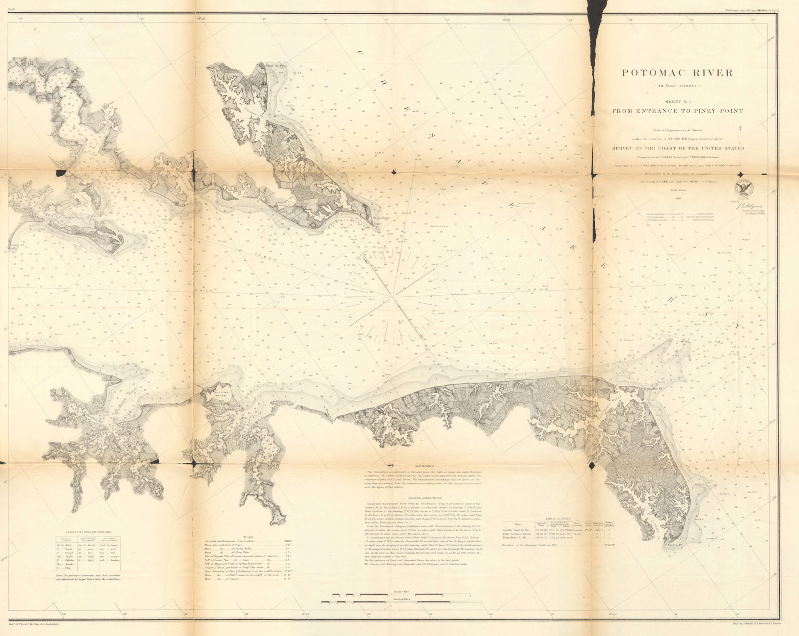
Title of map: 'Potomac river sheet No. 1 from entrance to piney point from a trigonometrical survey under the direction off A.D. Bache Superintendent of the survey of the Coast of the United States'
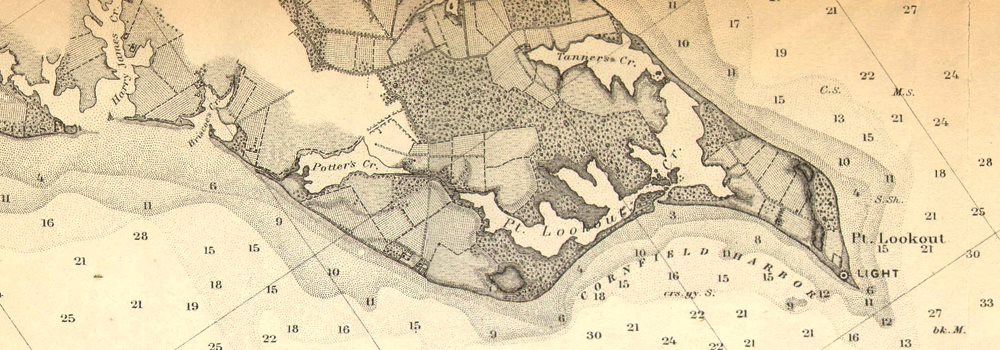
The image below shows an enlarged cross section from the centre of the map to show the level of printed detail. This map is folding hence the centrefold line may show on the image below:
DATE PRINTED: 1871
IMAGE SIZE: Approx 61.0 x 77.0cm, 24 x 30.25 inches (Large); Please note that this is a folding map.
ARTIST/CARTOGRAPHER/ENGRAVER: United States Coast & Geodetic Survey
PROVENANCE: "Report of the Superintendent of the United States Coast Survey-1868"; Published by Government Printing Office, Washington [United States Coast & Geodetic Survey]
TYPE: Antique survey map chart; Scale 1:600,000
VERSO: There is nothing printed on the reverse side, which is plain
CONDITION: Poor: The map has undergone repairs. The paper is brittle, fragile, susceptible to tearing and at risk of loss from flaking. There may be small tears to the map and additional paper loss may have occurred compared to that shown in the scan. The map is incomplete - small parts of the map may be missing; see the scan. The map suffers from wear and splitting at some of the junctions of the folds. The map has split along part of one or more of the folds. . Please note any other blemishes on the scan prior to purchasing this picture. Virtually all antiquarian maps and prints are subject to some normal aging due to use and time which is not obtrusive unless otherwise stated. I offer a no questions asked return policy - see below.
AUTHENTICITY: This is an authentic historic print, published at the date stated above. I do not offer reproductions. It is not a modern copy. The term 'original' when applied to a print means that it was printed at the first or original date of publication; it does not imply that the item is unique. 'Print' means any image created by applying an inked block to paper or card under pressure by any method including wood engraving, steel engraving, copperplate, wood cut and lithography.
REMARKS: FRANCE: Gravures et Cartes anciennes. DEUTSCHLAND: Alte Lankarten und Stadt ansichten. ITALIA: Stampe e Mappe antiche. ESPAÑA: Mapas antiquos y impresiones antiguas. E and OE. Force Majeure. English law shall apply.
RETURNS POLICY: I offer a no questions returns policy. All I ask is that you pay return shipping and mail back to me in original condition, suitably packed & insured, within 14 days of receipt.