'Carte géographique, statistique et historique de Massachusetts'
Very decorative early 19th century antique hand-coloured engraved map. Text in French., 1825
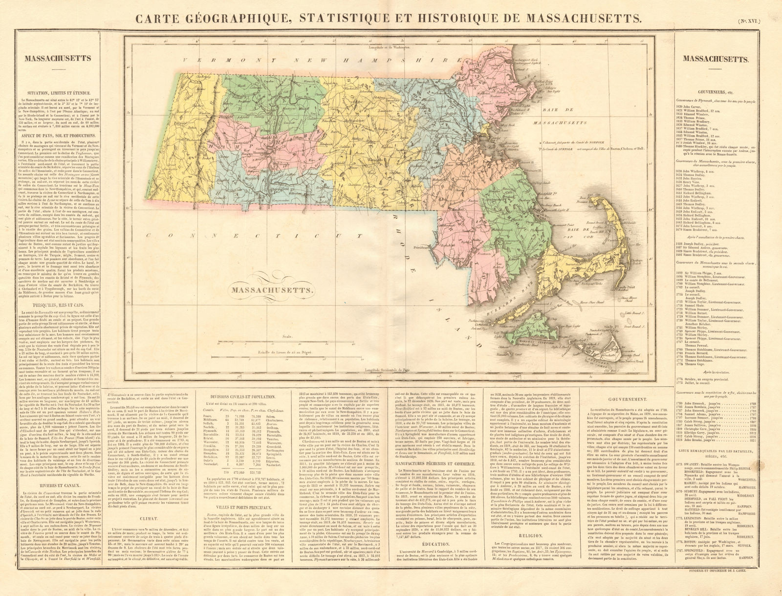
Title of map: 'Carte géographique, statistique et historique de Massachusetts'
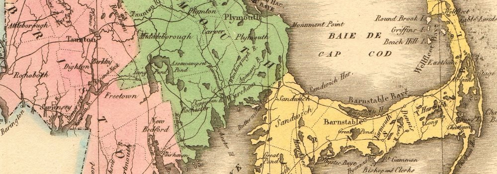
The image below shows an enlarged cross section from the centre of the map to show the level of printed detail. This map is folding hence the centrefold line may show on the image below:
The state boundary is drawn to include Boston Corner, now an outlying hamlet of Ancram in Columbia County, New York. Formerly part of the town of Mount Washington, in the extreme westerly corner of Massachusetts, the state boundary was redrawn to annex this area to New York State in 1857, because of its geographical isolation from the more populous part of Massachusetts. Nantucket, Martha's Vineyard, Cape Cod etc.
DATE PRINTED: 1825
IMAGE SIZE: Approx 50.0 x 66.0cm, 19.75 x 26 inches (Large); Please note that this is a folding map.
ARTIST/CARTOGRAPHER/ENGRAVER: Jean Alexandre Buchon
PROVENANCE: "Atlas géographique, statistique, historique et chronologique des Deux Amériques et des iles adjacentes"; par J.A. Buchon, dédié à S.A.R. Le Duc d'Orléans, à Paris, à la librairie de J. Carez, éditeur, Rue Haute feuille, no 18; Chez Verdiere, Quai des Augustins, no 25; Chez Bossange, père, Rue de Richelieu, No. 60. MDCCCXXV [Atlas des Deux Amériques]
TYPE: Very decorative early 19th century antique hand-coloured engraved map. Text in French.
VERSO: There is nothing printed on the reverse side, which is plain
CONDITION: Good; suitable for framing. Please check the scan for any blemishes prior to making your purchase. Virtually all antiquarian maps and prints are subject to some normal aging due to use and time which is not obtrusive unless otherwise stated. I offer a no questions asked return policy - see below.
AUTHENTICITY: This is an authentic historic print, published at the date stated above. I do not offer reproductions. It is not a modern copy. The term 'original' when applied to a print means that it was printed at the first or original date of publication; it does not imply that the item is unique. 'Print' means any image created by applying an inked block to paper or card under pressure by any method including wood engraving, steel engraving, copperplate, wood cut and lithography.
REMARKS: FRANCE: Gravures et Cartes anciennes. DEUTSCHLAND: Alte Lankarten und Stadt ansichten. ITALIA: Stampe e Mappe antiche. ESPAÑA: Mapas antiquos y impresiones antiguas. E and OE. Force Majeure. English law shall apply.
RETURNS POLICY: I offer a no questions returns policy. All I ask is that you pay return shipping and mail back to me in original condition, suitably packed & insured, within 14 days of receipt.