Ducatus Mantuani ceu Sedis belli 1733-1735 recentissima Delineatio una cum Confinijs Ducatus Medoil Parmensis Modenensis et Territ Veronensis et Bresciani [The Duchy of Mantua, seat of the recent war of 1733-1735 (War of the Polish Succession), with parts of the Duchies of Milan, Parma and Modena and the territories of Verona and Brescia]
Large antique 18th century atlas map, printed on thick, good quality paper with original outline hand colour/color , 1735
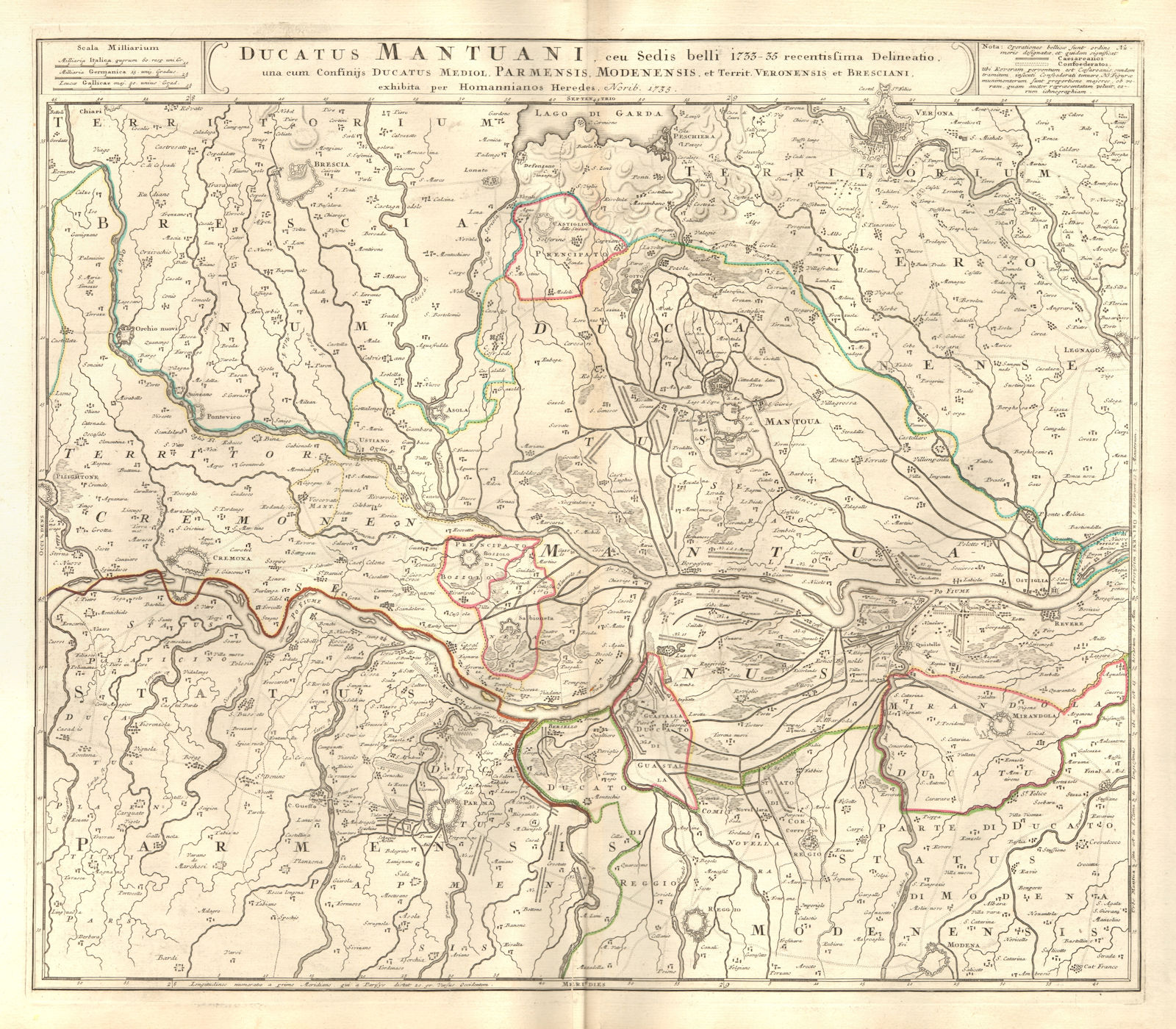
Title of the map: 'Ducatus Mantuani ceu Sedis belli 1733-1735 recentissima Delineatio una cum Confinijs Ducatus Medoil Parmensis Modenensis et Territ Veronensis et Bresciani [The Duchy of Mantua, seat of the recent war of 1733-1735 (War of the Polish Succession), with parts of the Duchies of Milan, Parma and Modena and the territories of Verona and Brescia]'
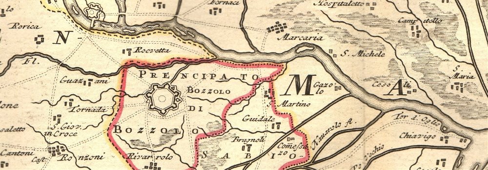
The image below shows an enlarged cross section from the centre of the map to show the level of printed detail. This map is folding hence the centrefold line may show on the image below:
This eighteenth century map shows part of the Po valley running through the Duchy of Mantua. It extends from the southern shore of Lake Garda in the north to Modena in the south, and from Piacenza in the west to Legnano in the east. Other fortified towns marked include Mirandola, Revere, Reggio Emilia, Parma, Cremona, Corregio, Mantua, Bozzolo, Sabbioneta, Asola, Brescia, Peschiera del Garda, Verona, Lonato
DATE PRINTED: 1735 (This date is printed on the map)
IMAGE SIZE: Approx 53.5 x 61.0cm, 21 x 24 inches (Large); Please note that this is a folding map.
ARTIST/CARTOGRAPHER/ENGRAVER: Johann Christoph Homann / Homann Heirs
PROVENANCE: The map was extracted from a "Composite atlas" of early 18th century maps, the latest of which was dated c1754
TYPE: Large antique 18th century atlas map, printed on thick, good quality paper with original outline hand colour/color
VERSO: There is nothing printed on the reverse side, which is plain
CONDITION: Very Good; suitable for framing. Please check the scan for any blemishes prior to making your purchase. Please contact us if you would like to arrange to view this map. Virtually all antiquarian maps and prints are subject to some normal aging due to use and time which is not obtrusive unless otherwise stated. I offer a no questions asked return policy - see below.
AUTHENTICITY: This is an authentic historic print, published at the date stated above. I do not offer reproductions. It is not a modern copy. The term 'original' when applied to a print means that it was printed at the first or original date of publication; it does not imply that the item is unique. 'Print' means any image created by applying an inked block to paper or card under pressure by any method including wood engraving, steel engraving, copperplate, wood cut and lithography.
REMARKS: FRANCE: Gravures et Cartes anciennes. DEUTSCHLAND: Alte Lankarten und Stadt ansichten. ITALIA: Stampe e Mappe antiche. ESPAÑA: Mapas antiquos y impresiones antiguas. E and OE. Force Majeure. English law shall apply.
RETURNS POLICY: I offer a no questions returns policy. All I ask is that you pay return shipping and mail back to me in original condition, suitably packed & insured, within 14 days of receipt.