Ducatus Saxoniae Superioris ut status ipsius antiquissimus suit per secula Xpriora sc post Chr. Nat ad Ann 1000 usque ex historiae Sax. Monumentis compilatus, et geographice designatus per Fridericum Zollmannum in publicum emisus ab Homannianis Heredibus. Norib A 1732 cum Privil. [The Duchy of Upper Saxony (Sachsen) as it was in ancient times before the 10th century]
Decorative antique eighteenth century atlas map, printed on thick paper, with original colouring and wide margins, c1735
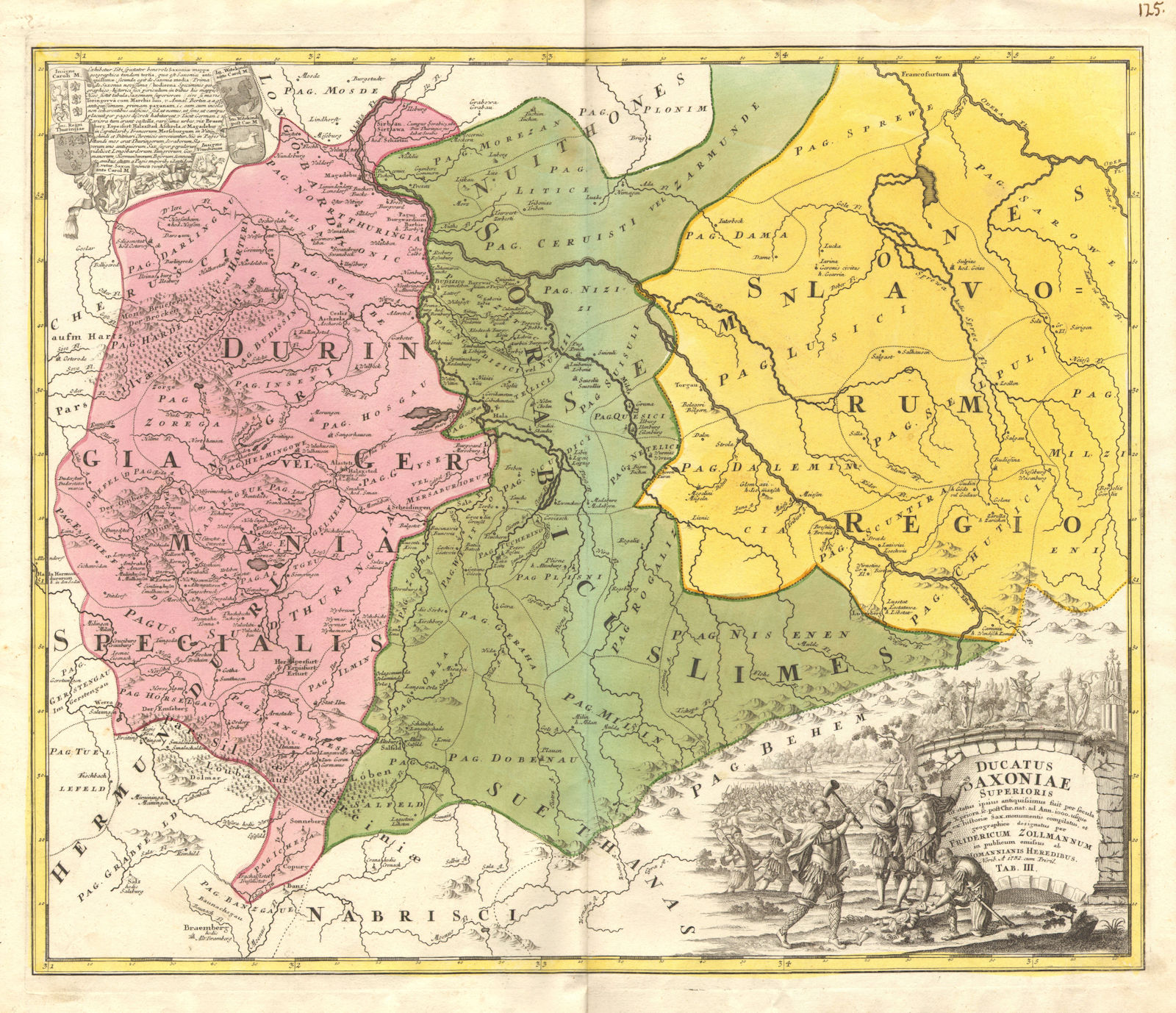
Title of map: 'Ducatus Saxoniae Superioris ut status ipsius antiquissimus suit per secula Xpriora sc post Chr. Nat ad Ann 1000 usque ex historiae Sax. Monumentis compilatus, et geographice designatus per Fridericum Zollmannum in publicum emisus ab Homannianis Heredibus. Norib A 1732 cum Privil. [The Duchy of Upper Saxony (Sachsen) as it was in ancient times before the 10th century]'
The image below shows an enlarged cross section from the centre of the map to show the level of printed detail. This map is folding hence the centrefold line may show on the image below:

Decorative title cartouche surrounded by images of pagan and Slavic gods, including Flins, Swantewith, Radegast and Zernibog (Chernobog) - whose effigy is being pulled down. Another effigy is being destroyed in the vignette adjacent to the title, presumably symbolising the rejection of pagan beliefs and the advent of Christianity during the dark ages
DATE PRINTED: 1732-1735
IMAGE SIZE: Approx 53.0 x 61.5cm, 20.75 x 24.25 inches (Large); Please note that this is a folding map.
ARTIST/CARTOGRAPHER/ENGRAVER: Friedrich Zollmann; Homann heirs
PROVENANCE: Published by Homann Heirs, Nuremberg
TYPE: Decorative antique eighteenth century atlas map, printed on thick paper, with original colouring and wide margins
VERSO: There is nothing printed on the reverse side, which is plain
CONDITION: Good; suitable for framing. Slightly creased in the bottom margin, otherwise very good. Please check the scan for any blemishes prior to making your purchase. Please contact us if you would like to arrange to view this map. Virtually all antiquarian maps and prints are subject to some normal aging due to use and time which is not obtrusive unless otherwise stated. I offer a no questions asked return policy - see below.
AUTHENTICITY: This is an authentic historic print, published at the date stated above. I do not offer reproductions. It is not a modern copy. The term 'original' when applied to a print means that it was printed at the first or original date of publication; it does not imply that the item is unique. 'Print' means any image created by applying an inked block to paper or card under pressure by any method including wood engraving, steel engraving, copperplate, wood cut and lithography.
REMARKS: FRANCE: Gravures et Cartes anciennes. DEUTSCHLAND: Alte Lankarten und Stadt ansichten. ITALIA: Stampe e Mappe antiche. ESPAÑA: Mapas antiquos y impresiones antiguas. E and OE. Force Majeure. English law shall apply.
RETURNS POLICY: I offer a no questions returns policy. All I ask is that you pay return shipping and mail back to me in original condition, suitably packed & insured, within 14 days of receipt.