'Dungarvan'
Antique lithographic map with original outline hand colour, 1832
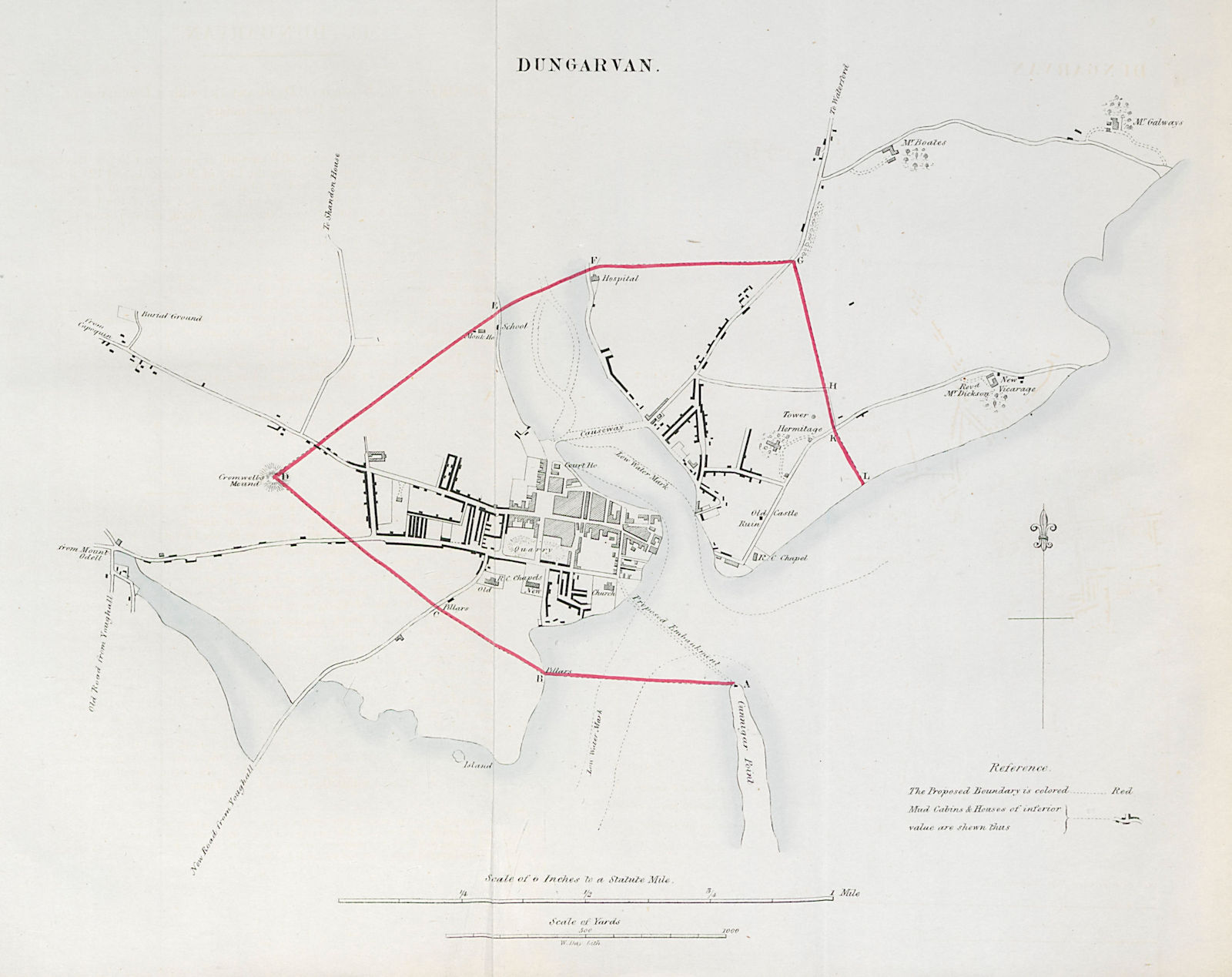
Title of map: 'Dungarvan'
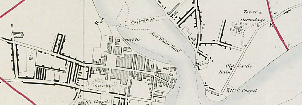
The image below shows an enlarged cross section from the centre of the map to show the level of printed detail. This map is folding hence the centrefold line may show on the image below:
This map was published within the 1832 Reform Act for the purposes of showing the proposed electoral borough constituency. At this time, the House of Commons elected members for two types of constituencies: counties, and boroughs. Many of the pre-reform boroughs had small electorates which were under the control of rich landowners; the so-called "rotten" or pocket boroughs. Conversely, in the industrial towns and cities which were growing strongly as a result of the industrial revolution, the burgeoning urban populations had become substantially under-represented. The Reform Bill redistributed parliamentary seats, enlarging or disenfranchising rotten boroughs, and recognising the emerging industrial towns. For existing boroughs, the maps show the old, unreformed boundaries (in green), and the boundaries of the reformed or new borough (in red). Parish or townships boundaries are shown on some of the maps in brown. Other places marked on the map include Tottington, Heywood. Lancashire.
DATE PRINTED: 1832
IMAGE SIZE: Approx 30.0 x 38.0cm, 11.75 x 15 inches (Large); Please note that this is a folding map.
ARTIST/CARTOGRAPHER/ENGRAVER: W. Day, Lithographer. From the Ordnance Survey. Thought to have been overseen by Robert Kearsley Dawson
PROVENANCE: "Parliamentary Representation: Boundary Reports - Ireland: Session 6 Dec 1831-16 Aug 1832 VOL XLIII", ordered by the House of Commons to be printed, 8 June 1832
TYPE: Antique lithographic map with original outline hand colour
VERSO: There is nothing printed on the reverse side, which is plain
CONDITION: Good; suitable for framing. Please check the scan for any blemishes prior to making your purchase. Virtually all antiquarian maps and prints are subject to some normal aging due to use and time which is not obtrusive unless otherwise stated. I offer a no questions asked return policy - see below.
AUTHENTICITY: This is an authentic historic print, published at the date stated above. I do not offer reproductions. It is not a modern copy. The term 'original' when applied to a print means that it was printed at the first or original date of publication; it does not imply that the item is unique. 'Print' means any image created by applying an inked block to paper or card under pressure by any method including wood engraving, steel engraving, copperplate, wood cut and lithography.
REMARKS: FRANCE: Gravures et Cartes anciennes. DEUTSCHLAND: Alte Lankarten und Stadt ansichten. ITALIA: Stampe e Mappe antiche. ESPAÑA: Mapas antiquos y impresiones antiguas. E and OE. Force Majeure. English law shall apply.
RETURNS POLICY: I offer a no questions returns policy. All I ask is that you pay return shipping and mail back to me in original condition, suitably packed & insured, within 14 days of receipt.