'Atlantic Islands // Cape Verde Ids. // Canary Ids. // Madeira Ids. // Azore Ids. // Road of Fayal with Porto Pin in the island of Fayal // The peak of Teneriffe'
Antique early 19th century atlas map with original hand colouring, 1830
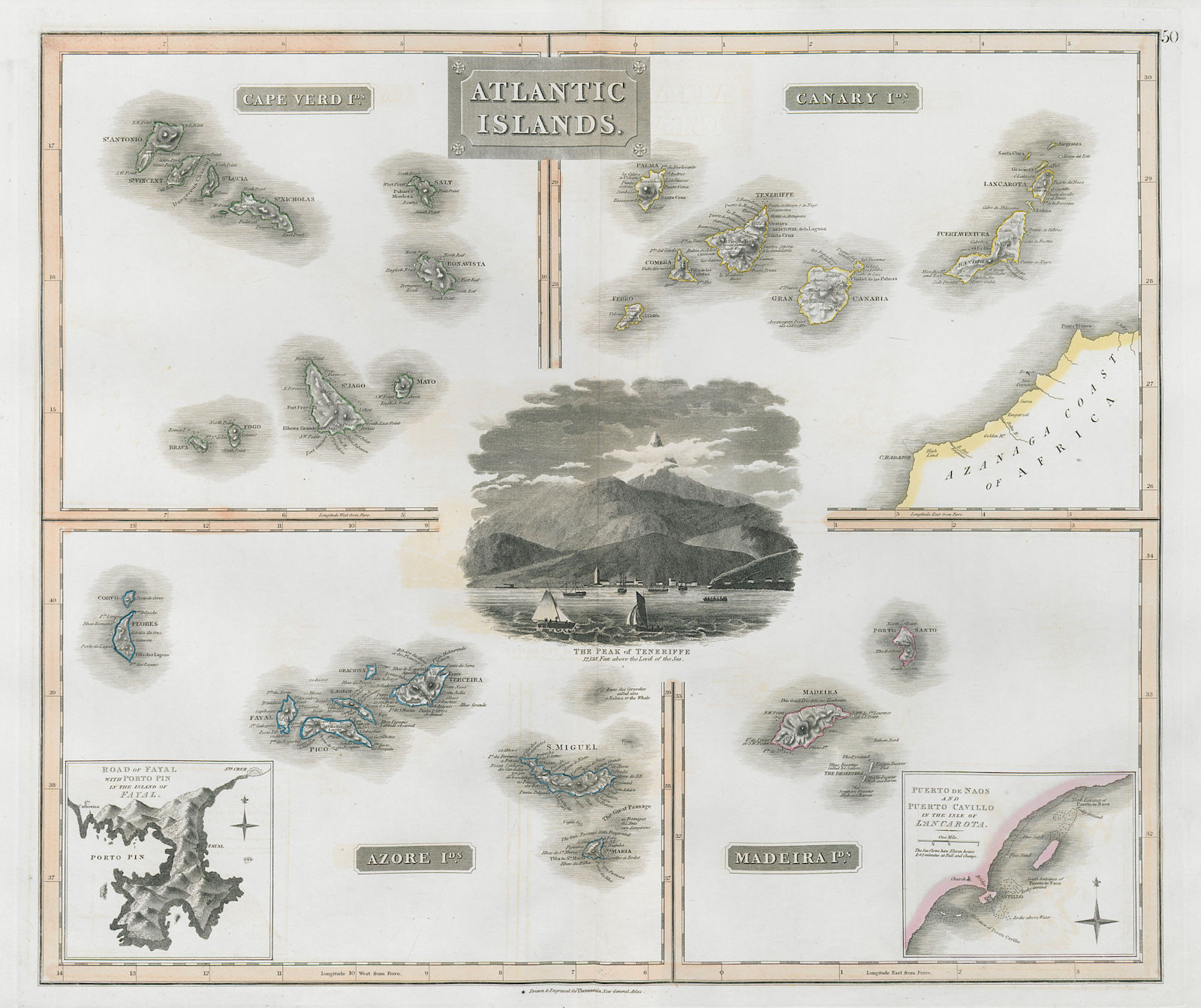
Title of map: 'Atlantic Islands // Cape Verde Ids. // Canary Ids. // Madeira Ids. // Azore Ids. // Road of Fayal with Porto Pin in the island of Fayal // The peak of Teneriffe'
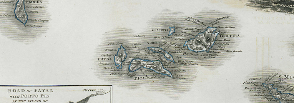
The image below shows an enlarged cross section from the centre of the map to show the level of printed detail. This map is folding hence the centrefold line may show on the image below:
A large, decorative chart of Macaronesia, consisting of the island groups of the Cape Verde Islands, the Canary Islands, the Azores & Madeira. There is a fine vignette view in the centre of the "Peak of Teneriffe" (Pico del Teide) from the sea, with a number of three-masted sailing ships. Inset bottom right is a chart of "Puerto de Naos and Puerto Cavillo in the isle of Lancarota" (now Arrecife, Lanzarote), and bottom left, a chart of the "Road of Fayal" (Horta, Ilha do Faial, Azores)
DATE PRINTED: 1830
IMAGE SIZE: Approx 53.0 x 63.0cm, 20.75 x 24.75 inches (Large); Please note that this is a folding map.
ARTIST/CARTOGRAPHER/ENGRAVER: Drawn & engraved by Thomas Clerk for John Thomson's "New General Atlas"
PROVENANCE: "A new general atlas", consisting of a series of geographical designs, on various projections, exhibiting the form and component parts of the globe; and a collection of maps and charts, delineating the natural and political divisions of the Empires, Kingdoms, and States in the World", Edinburgh: Printed by George Ramsay and Company, for John Thomson and Company, Edinburgh; Baldwin, Cradock, and Joy, London; and John Cumming, Dublin [Thomson's New General Atlas]
TYPE: Antique early 19th century atlas map with original hand colouring
VERSO: There is nothing printed on the reverse side, which is plain
CONDITION: Good; suitable for framing. Please check the scan for any blemishes prior to making your purchase. Please contact us if you would like to arrange to view this map. Virtually all antiquarian maps and prints are subject to some normal aging due to use and time which is not obtrusive unless otherwise stated. I offer a no questions asked return policy - see below.
AUTHENTICITY: This is an authentic historic print, published at the date stated above. I do not offer reproductions. It is not a modern copy. The term 'original' when applied to a print means that it was printed at the first or original date of publication; it does not imply that the item is unique. 'Print' means any image created by applying an inked block to paper or card under pressure by any method including wood engraving, steel engraving, copperplate, wood cut and lithography.
REMARKS: FRANCE: Gravures et Cartes anciennes. DEUTSCHLAND: Alte Lankarten und Stadt ansichten. ITALIA: Stampe e Mappe antiche. ESPAÑA: Mapas antiquos y impresiones antiguas. E and OE. Force Majeure. English law shall apply.
RETURNS POLICY: I offer a no questions returns policy. All I ask is that you pay return shipping and mail back to me in original condition, suitably packed & insured, within 14 days of receipt.