'London Transport - Underground Lines No 2. 1938'
Vintage diagram of lines pocket map issued by London Transport, 1938
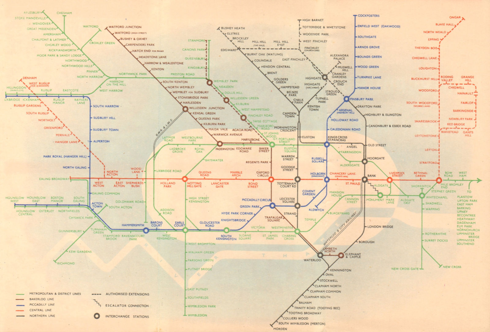
Title of map: 'London Transport - Underground Lines No 2. 1938'
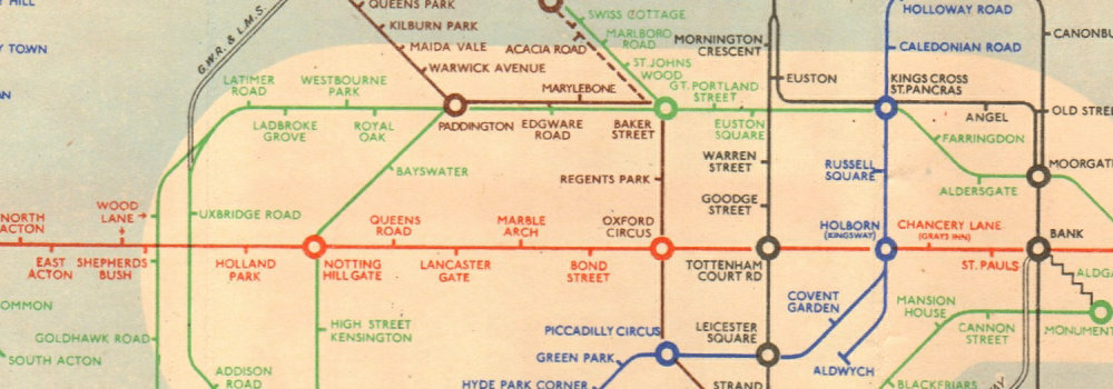
The image below shows an enlarged cross section from the centre of the map to show the level of printed detail. This map is folding hence the centrefold line may show on the image below:
A map of the Underground network by Hans Schleger (who went under the pseudoynm of "Zero") with airbrushed background which emphasises the central area. Authorised extensions are included as a dotted line as used for the Central line extensions to Denham and Ongar, the extensions on the Northern line to Bushey Heath, High Barnet and Alexandra Palace and the Bakerloo extension to Stanmore. The District and Piccadilly lines to Hounslow West are horizontal, as is the Central line to Ealing Broadway. The Metropolitan line is shown as far as Aylesbury with the branch to Chesham. The GWR and LMS line between Uxbridge Road and Willesden Junction are included, as is the Waterloo & City Railway. The front cover is red with a small black roundel, and there are four maps of parts of Central London on the back. The map shows as under construction the "New Works Plan" (Northern Heights project) to take over the ex-GNR line between Finsbury Park and Edgware and High Barnet, including the Alexandra Palace branch. These were to be incorporated into the Northern Line with a new connection with the Northern City line at Finsbury Park, and an extension from Edgware to Bushey Heath. The project was abandoned at the onset of World War 2 and never restarted, though these lines continued to be shown as under construction until 1950. The Central Line extension to the west is shown as being under construction as far as Denham (though it eventually was only completed as far as West Ruislip), and to Ongar in the east. The map includes the "Middle Circle", an underground train line using the West London Railway between Latimer Road and Earls Court, passing through Uxbridge Road and Addison Road. The line closed in 1940 following bomb damage. It was not reopened until 2008 as part of the Overground network. The Metropolitan Line to Stanmore is shown alongside the Bakerloo Line (to which line this route was transferred in 1939 - now part of the Jubilee line). The Metropolitan Line includes "Marlboro" (Marlborough) Road station, closed upon transfer to the Bakerloo line in 1939, while the dotted Bakerloo line includes Acacia Road station - the original proposed names for St John's Wood station.
DATE PRINTED: No.2 1938
IMAGE SIZE: Approx 15.0 x 22.5cm, 6 x 8.75 inches (Medium); Please note that this is a folding map.
ARTIST/CARTOGRAPHER/ENGRAVER: Hans Schleger ("Zero")
PROVENANCE: London Transport, printed by Johnson, Riddle & Co, London SE1. Crown Copyright
TYPE: Vintage diagram of lines pocket map issued by London Transport
VERSO: There is related information and images printed on the reverse side of the picture
CONDITION: Good; suitable for framing. However, please note: The image shown may have been taken from a different example of this map than that which is offered for sale. The map you will receive is in good condition but there may be minor variations in the condition from that shown in the image. Please check the scan for any blemishes prior to making your purchase. Please contact us if you would like to arrange to view this map. Virtually all antiquarian maps and prints are subject to some normal aging due to use and time which is not obtrusive unless otherwise stated. I offer a no questions asked return policy - see below.
AUTHENTICITY: This is an authentic historic print, published at the date stated above. I do not offer reproductions. It is not a modern copy. The term 'original' when applied to a print means that it was printed at the first or original date of publication; it does not imply that the item is unique. 'Print' means any image created by applying an inked block to paper or card under pressure by any method including wood engraving, steel engraving, copperplate, wood cut and lithography.
REMARKS: FRANCE: Gravures et Cartes anciennes. DEUTSCHLAND: Alte Lankarten und Stadt ansichten. ITALIA: Stampe e Mappe antiche. ESPA�A: Mapas antiquos y impresiones antiguas. E and OE. Force Majeure. English law shall apply.
RETURNS POLICY: I offer a no questions returns policy. All I ask is that you pay return shipping and mail back to me in original condition, suitably packed & insured, within 14 days of receipt.