'Creplegate Ward'
Copperplate engraved map, 1720
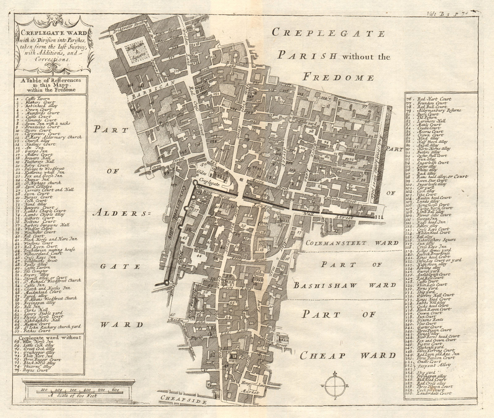
Title of map: 'Creplegate Ward'
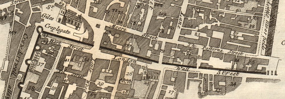
The image below shows an enlarged cross section from the centre of the map to show the level of printed detail. This map is folding hence the centrefold line may show on the image below:
The map covers part of the City of London around St Giles Cripplegate. The old London Wall (parts of which still exist) bisects the map. The Barbican (substantially redeveloped after World War 2) is shown top left. Wood Street and Aldermanbury/Milk Street run from London Wall down to Cheapside, at the bottom of the map. The map runs east to Moorfields.
DATE PRINTED: 1720
IMAGE SIZE: Approx 31.0 x 37.0cm, 12.25 x 14.5 inches (Large); Please note that this is a folding map.
ARTIST/CARTOGRAPHER/ENGRAVER: Published by John Strype from a plate originally published by John Stow
PROVENANCE: "A survey of the cities of London and Westminster, containing the original, antiquity, increase, modern estate and government of those cities. Written at first in the year 1598, by John Stow, citizen and native of London .... Corrected, improved, and very much enlarged ... by John Strype, MA, a native also of the said city", London, printed for A. Churchill, J. Knapton, R. Knaplock, J. Walthoe, E. Horne, B. Tooke, D. Midwinter, B. Cowse, R. Robinson, and T.Ward, MDCCXX [Stow's survey of London]
TYPE: Copperplate engraved map
VERSO: There is nothing printed on the reverse side, which is plain
CONDITION: Good; suitable for framing. However, please note: The image shown may have been taken from a different example of this map than that which is offered for sale. The map you will receive is in good condition but there may be minor variations in the condition from that shown in the image. Please check the scan for any blemishes prior to making your purchase. Virtually all antiquarian maps and prints are subject to some normal aging due to use and time which is not obtrusive unless otherwise stated. I offer a no questions asked return policy - see below.
AUTHENTICITY: This is an authentic historic print, published at the date stated above. I do not offer reproductions. It is not a modern copy. The term 'original' when applied to a print means that it was printed at the first or original date of publication; it does not imply that the item is unique. 'Print' means any image created by applying an inked block to paper or card under pressure by any method including wood engraving, steel engraving, copperplate, wood cut and lithography.
REMARKS: FRANCE: Gravures et Cartes anciennes. DEUTSCHLAND: Alte Lankarten und Stadt ansichten. ITALIA: Stampe e Mappe antiche. ESPAÑA: Mapas antiquos y impresiones antiguas. E and OE. Force Majeure. English law shall apply.
RETURNS POLICY: I offer a no questions returns policy. All I ask is that you pay return shipping and mail back to me in original condition, suitably packed & insured, within 14 days of receipt.