'London Underground Transport - Railway Map No 2. 1934' (No print code)
Vintage diagram of lines pocket map issued by London Transport, 1934
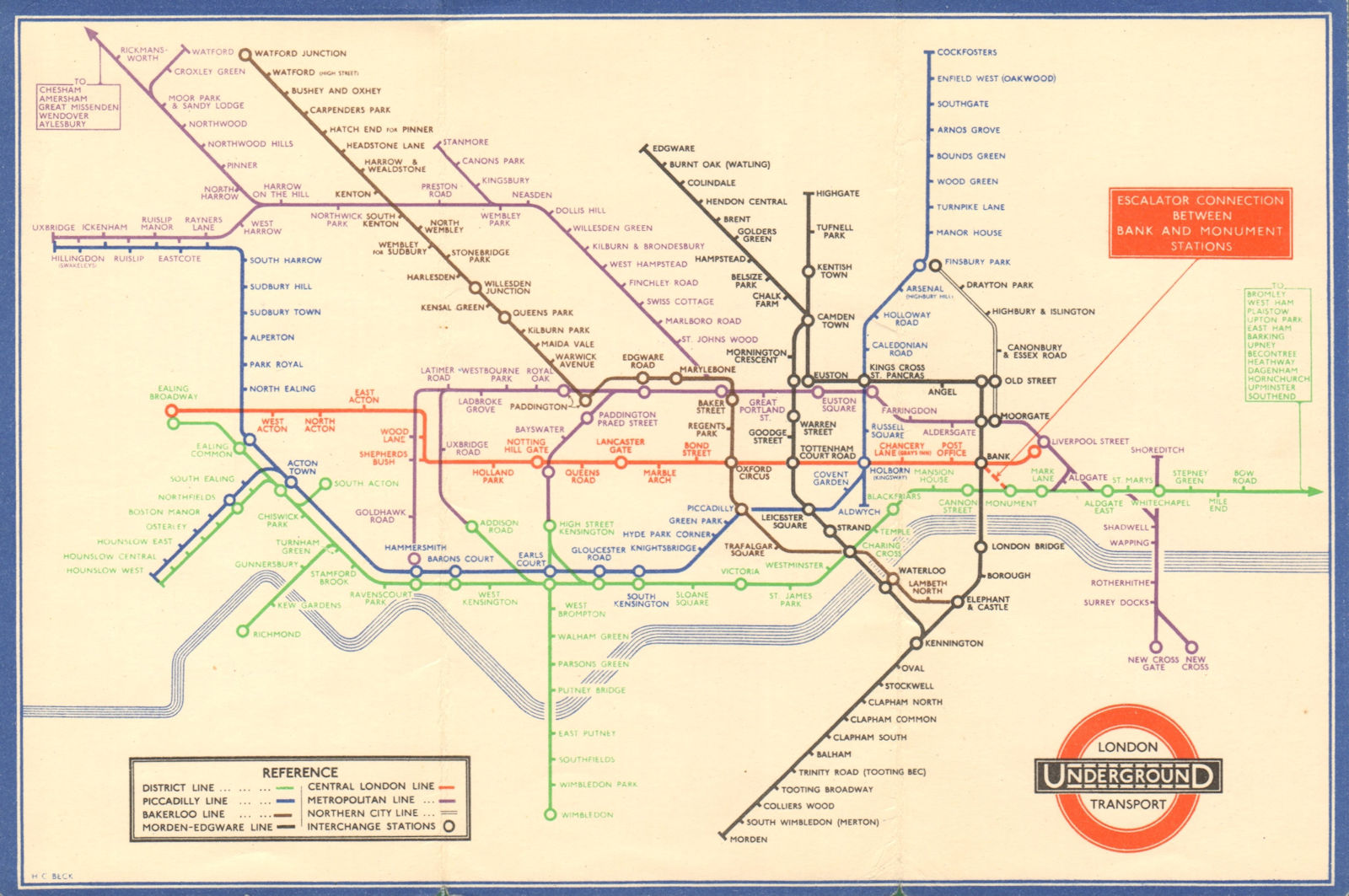
Title of map: 'London Underground Transport - Railway Map No 2. 1934'
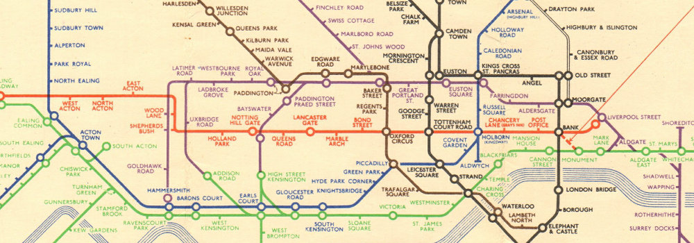
The image below shows an enlarged cross section from the centre of the map to show the level of printed detail. This map is folding hence the centrefold line may show on the image below:
This edition of the Beck diagram shows changes to the colour of some lines. The Central London line is drawn in red instead of orange, the Northern City line is now black, the Bakerloo line has changed from red to brown and the East London Line has become part of the Metropolitan line. The Piccadilly line service is shown extending to Uxbridge. Changes in the names of lines and stations are also shown on this edition of the map, the Edgware, Highgate & Morden line is refered to as the Morden - Edgware line, the Great Northern & City Line has become the Northern City Line and Enfield West is now refered to as Enfield West (Oakwood). On the reverse of the map are listed Places of Interest & Theatres and the front cover has a decorative border. The map includes the "Middle Circle", an underground train line using the West London Railway between Latimer Road and Earls Court, passing through Uxbridge Road and Addison Road. The line closed in 1940 following bomb damage. It was not reopened until 2008 as part of the Overground network.
DATE PRINTED: No.2 1934
IMAGE SIZE: Approx 15.0 x 22.5cm, 5.75 x 8.75 inches (Medium); Please note that this is a folding map.
ARTIST/CARTOGRAPHER/ENGRAVER: Harry C. Beck
PROVENANCE: London Transport, printed by Johnson, Riddle & Co, London SE1
TYPE: Vintage diagram of lines pocket map issued by London Transport
VERSO: There is related information and images printed on the reverse side of the picture
CONDITION: Good; suitable for framing. However, please note: The image shown may have been taken from a different example of this map than that which is offered for sale. The map you will receive is in good condition but there may be minor variations in the condition from that shown in the image. Please check the scan for any blemishes prior to making your purchase. Please contact us if you would like to arrange to view this map. Virtually all antiquarian maps and prints are subject to some normal aging due to use and time which is not obtrusive unless otherwise stated. I offer a no questions asked return policy - see below.
AUTHENTICITY: This is an authentic historic print, published at the date stated above. I do not offer reproductions. It is not a modern copy. The term 'original' when applied to a print means that it was printed at the first or original date of publication; it does not imply that the item is unique. 'Print' means any image created by applying an inked block to paper or card under pressure by any method including wood engraving, steel engraving, copperplate, wood cut and lithography.
REMARKS: FRANCE: Gravures et Cartes anciennes. DEUTSCHLAND: Alte Lankarten und Stadt ansichten. ITALIA: Stampe e Mappe antiche. ESPA�A: Mapas antiquos y impresiones antiguas. E and OE. Force Majeure. English law shall apply.
RETURNS POLICY: I offer a no questions returns policy. All I ask is that you pay return shipping and mail back to me in original condition, suitably packed & insured, within 14 days of receipt.