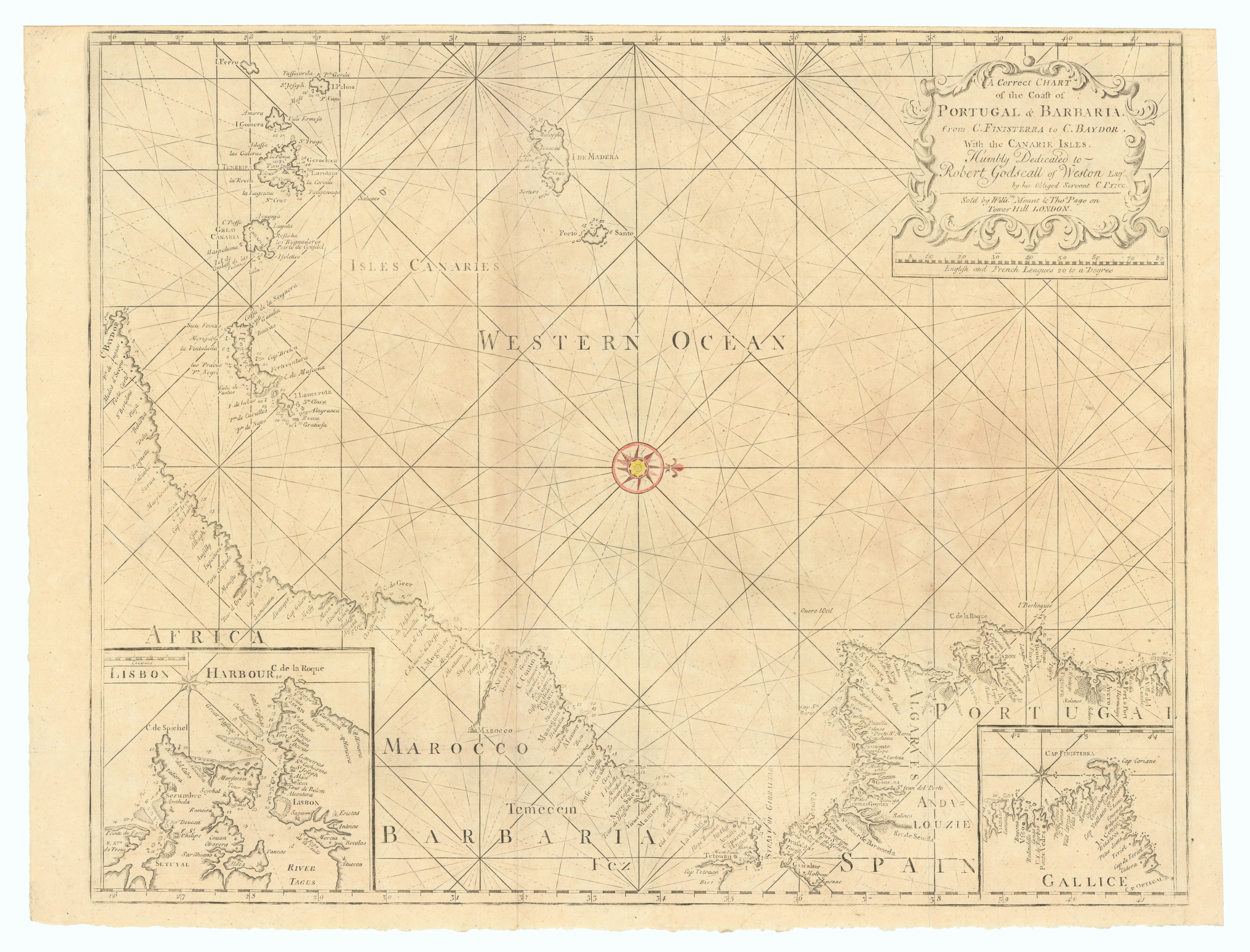
'A Correct Chart of the Coast of Portugal & Barbaria from C. Finisterra to C. Baydor. With the Canarie Isles. Humbly Dedicated to Robert Godscall of Weston Esqr. By his Obliged servant C. Price // Lisbon Harbour'
Antique 18th century copperplate sea chart, 1758

Caption below picture: 88: 'A Correct Chart of the Coast of Portugal & Barbaria from C. Finisterra to C. Baydor. With the Canarie Isles. Humbly Dedicated to Robert Godscall of Weston Esqr. By his Obliged servant C. Price // Lisbon Harbour'
Antique folio sea chart of the coast of Galicia, Portugal, the Strait of Gibraltar, the Atlantic coast of Morocco, the Canary Islands and Madeira, with an inset map of Lisbon Harbour. Decorative title cartouche top right with dedication to Robert Godschall, Master of the Worshipful Company of Ironmongers and Lord Mayor of London
DATE PRINTED: 1758
IMAGE SIZE: Approx 51.5 x 67.5cm, 20.25 x 26.75 inches (Large); Please note that this is a folding map.
ARTIST/CARTOGRAPHER/ENGRAVER: William Mount and Thomas Page
PROVENANCE: "The English Pilot - Part I, describing the sea-coasts, capes, headlands, bays, roads, harbours, rivers and ports. Together with the soundings, sands, rocks and dangers in the Southern Navigation upon the coasts of England, Scotland, Ireland, Holland, Flanders, Spain, Portugal, to the Streights-Mouth; with the Coasts of Barbary, and off to the Canary, Madera, Cape de Verde and Western Islands shewing the courses and distances, from one place to another. The setting of the tides and currents. The ebbing and flowing of the sea &c.", London, printed for W. and J. Mount and T. Page, at the Postern on Tower-Hill, MDCCXLIX
TYPE: Antique 18th century copperplate sea chart
VERSO: There is nothing printed on the reverse side, which is plain
CONDITION: Good; suitable for framing. Please check the scan for any blemishes prior to making your purchase. Virtually all antiquarian maps and prints are subject to some normal aging due to use and time which is not obtrusive unless otherwise stated. I offer a no questions asked return policy - see below.
AUTHENTICITY: This is an authentic historic print, published at the date stated above. I do not offer reproductions. It is not a modern copy. The term 'original' when applied to a print means that it was printed at the first or original date of publication; it does not imply that the item is unique. 'Print' means any image created by applying an inked block to paper or card under pressure by any method including wood engraving, steel engraving, copperplate, wood cut and lithography.
REMARKS: FRANCE: Gravures et Cartes anciennes. DEUTSCHLAND: Alte Lankarten und Stadt ansichten. ITALIA: Stampe e Mappe antiche. ESPA�A: Mapas antiquos y impresiones antiguas. E and OE. Force Majeure. English law shall apply.
RETURNS POLICY: I offer a no questions returns policy. All I ask is that you pay return shipping and mail back to me in original condition, suitably packed & insured, within 14 days of receipt.