'Oc�an Atlantique Sud - Ile de Fernando-Noronha'
Antique 19th century engraved French sea chart with old colour, 1873
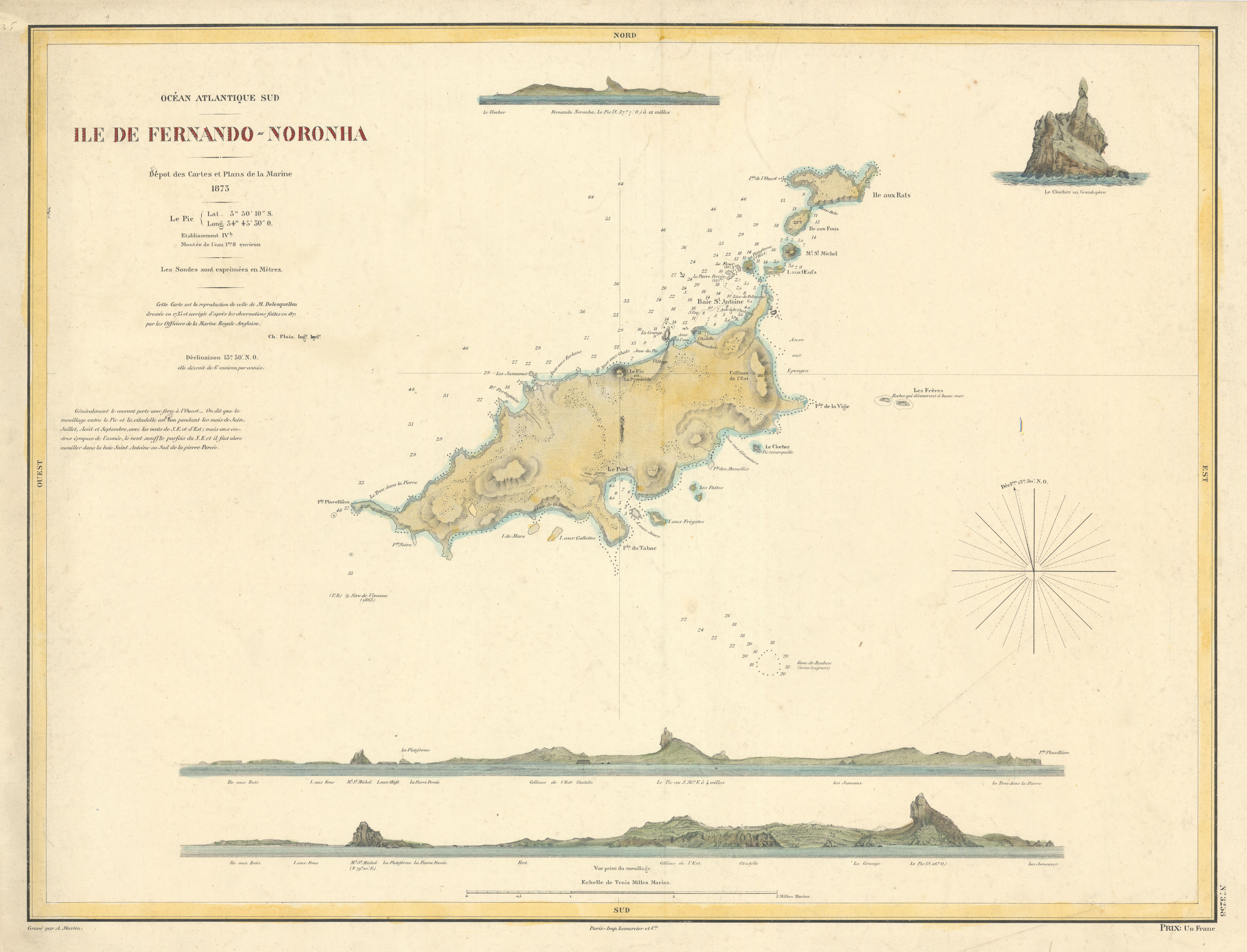
Caption below picture: 'Oc�an Atlantique Sud - Ile de Fernando-Noronha'
French sea chart of the Brazilian archipelago of Fernando de Noronha, with coast profiles including the prominent Rocha N�ga
DATE PRINTED: 1873
IMAGE SIZE: Approx 48.5 x 63.5cm, 19 x 25 inches (Large)
ARTIST/CARTOGRAPHER/ENGRAVER: Ch. Ploix, after M. Delesquellen (1735) corrected after observations by the British Royal Navy (1871)
PROVENANCE: Depot des Cartes et Plans de la Marine. Paris - Imp. Lemercier et Cie
TYPE: Antique 19th century engraved French sea chart with old colour
VERSO: There is nothing printed on the reverse side, which is plain
CONDITION: Good; suitable for framing. Please check the scan for any blemishes prior to making your purchase. Please contact us if you would like to arrange to view this map. Virtually all antiquarian maps and prints are subject to some normal aging due to use and time which is not obtrusive unless otherwise stated. I offer a no questions asked return policy - see below.
AUTHENTICITY: This is an authentic historic print, published at the date stated above. I do not offer reproductions. It is not a modern copy. The term 'original' when applied to a print means that it was printed at the first or original date of publication; it does not imply that the item is unique. 'Print' means any image created by applying an inked block to paper or card under pressure by any method including wood engraving, steel engraving, copperplate, wood cut and lithography.
REMARKS: FRANCE: Gravures et Cartes anciennes. DEUTSCHLAND: Alte Lankarten und Stadt ansichten. ITALIA: Stampe e Mappe antiche. ESPA�A: Mapas antiquos y impresiones antiguas. E and OE. Force Majeure. English law shall apply.
RETURNS POLICY: I offer a no questions returns policy. All I ask is that you pay return shipping and mail back to me in original condition, suitably packed & insured, within 14 days of receipt.