'Sheet G2 - Whitechapel Road, Shadwell, Stepney Green, Commercial Road, The Highway, Ratcliff'
Antique copperplate map, 1799
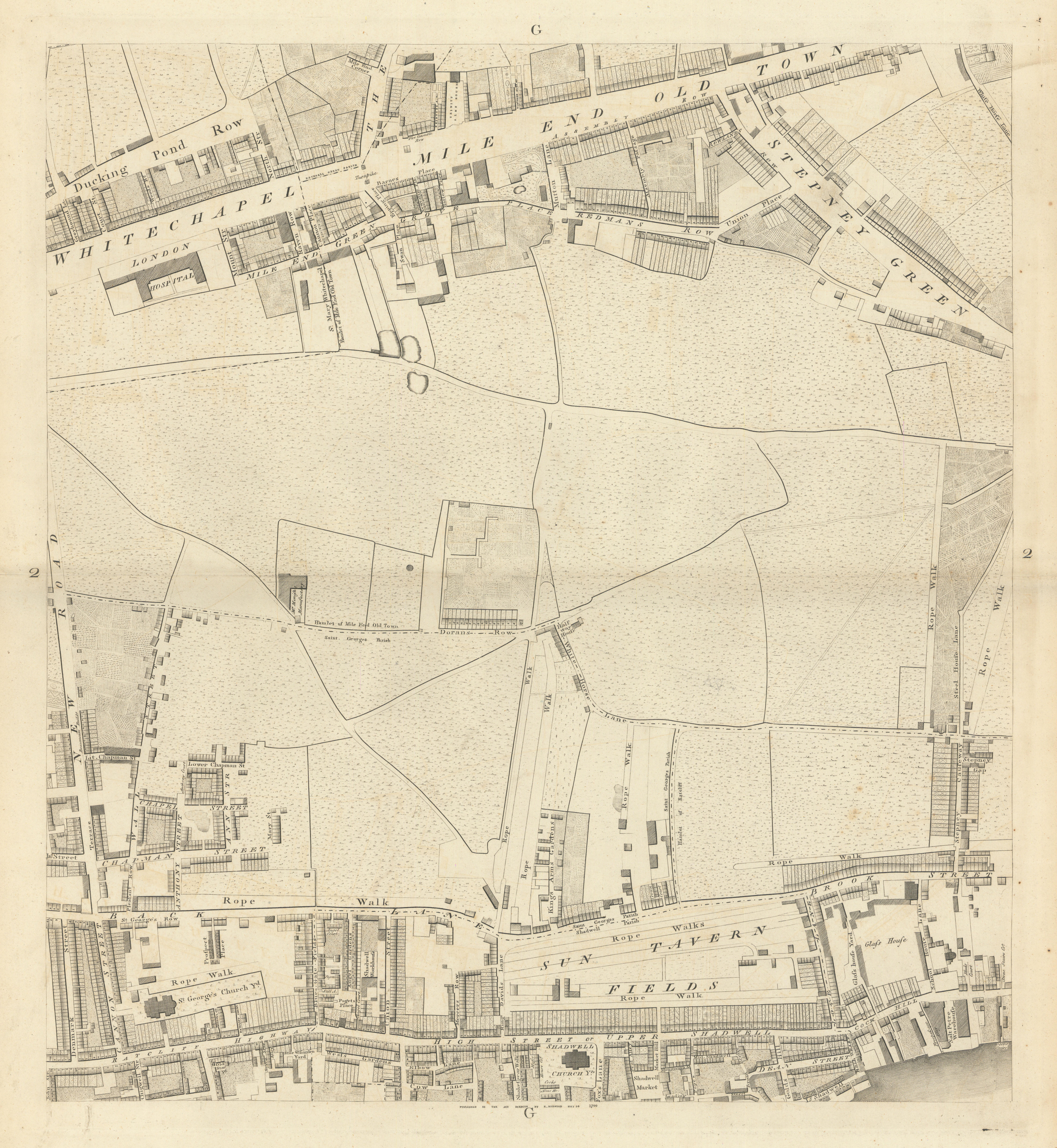
Caption below picture: 'Sheet G2 - Whitechapel Road, Shadwell, Stepney Green, Commercial Road, The Highway, Ratcliff'
DATE PRINTED: 1799
IMAGE SIZE: Approx 59.0 x 54.5cm, 23.25 x 21.5 inches (Large); Please note that this is a folding map.
ARTIST/CARTOGRAPHER/ENGRAVER: Richard Horwood
PROVENANCE: A plan of the Cities of London & Westminster, the Borough of Southwark and Parts adjoining, Shewing every House, by R. Horwood [Howgego 94 (1)]
TYPE: Antique copperplate map
VERSO: There is nothing printed on the reverse side, which is plain
CONDITION: Good; suitable for framing. Please check the scan for any blemishes prior to making your purchase. Please contact us if you would like to arrange to view this map. Virtually all antiquarian maps and prints are subject to some normal aging due to use and time which is not obtrusive unless otherwise stated. I offer a no questions asked return policy - see below.
AUTHENTICITY: This is an authentic historic print, published at the date stated above. I do not offer reproductions. It is not a modern copy. The term 'original' when applied to a print means that it was printed at the first or original date of publication; it does not imply that the item is unique. 'Print' means any image created by applying an inked block to paper or card under pressure by any method including wood engraving, steel engraving, copperplate, wood cut and lithography.
REMARKS: FRANCE: Gravures et Cartes anciennes. DEUTSCHLAND: Alte Lankarten und Stadt ansichten. ITALIA: Stampe e Mappe antiche. ESPA�A: Mapas antiquos y impresiones antiguas. E and OE. Force Majeure. English law shall apply.
RETURNS POLICY: I offer a no questions returns policy. All I ask is that you pay return shipping and mail back to me in original condition, suitably packed & insured, within 14 days of receipt.